![]()
![]()
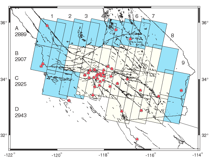
The following is a map of the ERS-1/2 SAR frames available for the Southern California region (descending passes only). Red triangles represent Southern California Integrated GPS Network (SCIGN) stations, black lines indicate faults. The grid A1 to D9 represents the SAR frames - frame numbers are shown (2889 for A to 2943 for D). Click on any grid location listed in the table below the map to access a listing of available images and raw parameter files for that region.
| available frames | A6 | A7 | B3 | B4 | B5 | B6 | B7 | C3 | C4 | C5 | C6 | C7 | C8 | D6 | D7 | D8 |
| raw parameter files | A6 | A7 | B3 | B4 | B5 | B6 | B7 | C3 | C4 | C5 | C6 | C7 | C8 | D6 | D7 | D8 |
Note: the lists of available images were compiled using the European Space Agency (ESA) webpages.
![]()
![]() Back to:
SAR group | SOPAC
| IGPP | SIO
Back to:
SAR group | SOPAC
| IGPP | SIO
![]()
Please email me if you have any problems with these pages.
Last modified: 5 May 1998