An InSAR processing system based on GMT
Xiaohua (Eric) Xu - University of Science and Technology of China
Rob Mellors - Scripps Institution of Oceanography
Xiaopeng Tong - China Earthquake Administration
Meng (Matt) Wei - University of Rhode Island
Looking for volunteers for testing and development
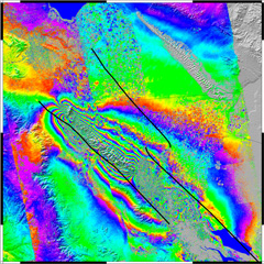
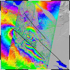
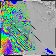
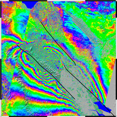
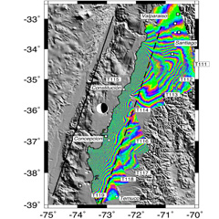
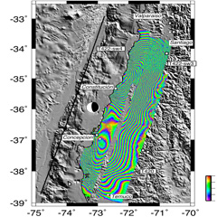
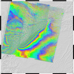
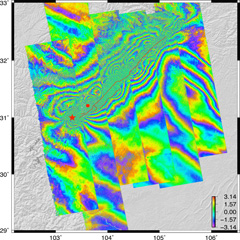

GMTSAR is an open source (GNU General Public License) InSAR processing system designed for users familiar with Generic Mapping Tools (GMT). The code is written in C and will compile on any computer where GMT and NETCDF are installed. The system has three main components:
- a preprocessor for each satellite data type (ERS-1/2, Envisat, ALOS-1, TerraSAR-X, COSMOS-SkyMed, Radarsat-2, Sentinel-1A/B, and ALOS-2) to convert the native format and orbital information into a generic format;
- an InSAR processor to focus and align stacks of images, map topography into phase, and form the complex interferogram;
- a postprocessor, mostly based on GMT, to filter the interferogram and construct interferometric products of phase, coherence, phase gradient, and line-of sight displacement in both radar and geographic coordinates;
GMT is used to display all the products as pdf files and KML images for Google Earth. A set of shell
scripts has been developed for standard 2-pass processing as well as geometric image alignment for stacking and time
series. Users are welcome to contribute
to this effort.
CITATION: Sandwell, D. ., R. . Mellors, X. Tong, M. Wei, and P. Wessel (2011), Open radar interferometry software for mapping surface deformation, Eos Trans. AGU, 92(28), doi:10.1029/2011EO280002.
Sandwell, D., Xu, X., Chen, J., Mellors, R., Wei, M., Tong, X., DeSanto, J., Ou, Qi, (2025), Satellite Radar Interferometry: Theory and Practice, in press, Cambridge UNiversity Press. pdf file
ACKNOWLEDGEMENTS: This research was supported by NASA Earth Surface and Interior Program, ConocoPhillips, the National Science Foundation CSSI Program, Scripps Institution of Oceanography, and San Diego State University.