|
|

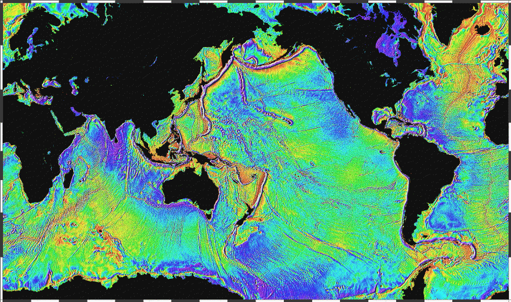
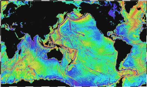
MARINE GRAVITY FROM SATELLITE ALTIMETRY
References
Sandwell, D. T., R. D. Müller, W. H. F. Smith, E. Garcia, R. Francis, New global marine gravity model from CryoSat-2 and Jason-1 reveals buried tectonic structure, Science, Vol. 346, no. 6205, pp. 65-67, doi: 10.1126/science.1258213, 2014.
Yu, Yao, David T. Sandwell, and Gerald Dibarboure. "Abyssal marine tectonics from the SWOT mission." Science 386, no. 6727 (2024): 1251-1256.
Yu, Yao, David T. Sandwell, Gérald Dibarboure, Curtis Chen, and Jinbo Wang. "Accuracy and resolution of SWOT altimetry: Foundation seamounts." Earth and Space Science 11, no. 6 (2024): e2024EA003581.
Reference: Garcia, E., D. T. Sandwell, W. H. F. Smith. Retracking CryoSat-2, Envisat, and Jason-1 Radar Altimetry Waveforms for Improved Gravity Field Recovery, Geophysical Journal International, doi: 10.1093/gji/ggt469, 2014.
Reference: Sandwell, D. T., E. Garcia, K. Soofi, P. Wessel, and W. H. F. Smith, Towards 1 mGal Global Marine Gravity from CryoSat-2, Envisat, and Jason-1, The Leading Edge, 32(8), 892899. doi: 10.1190/tle32080892.1, 2013.
Reference: Sandwell, D. T., and W. H. F. Smith, Global marine gravity from retracked Geosat and ERS-1 altimetry: Ridge Segmentation versus spreading rate, J. Geophys. Res., 114, B01411, doi:10.1029/2008JB006008, 2009.
Quick Contents
Interactive Maps
The maps below have been sectioned into 16 clickable regions.
Clicking on a particular region will open a new window showing the zoomed in region in
more detail.
|

|