
Xiaohua Xu and David Sandwell

Paper in prep.
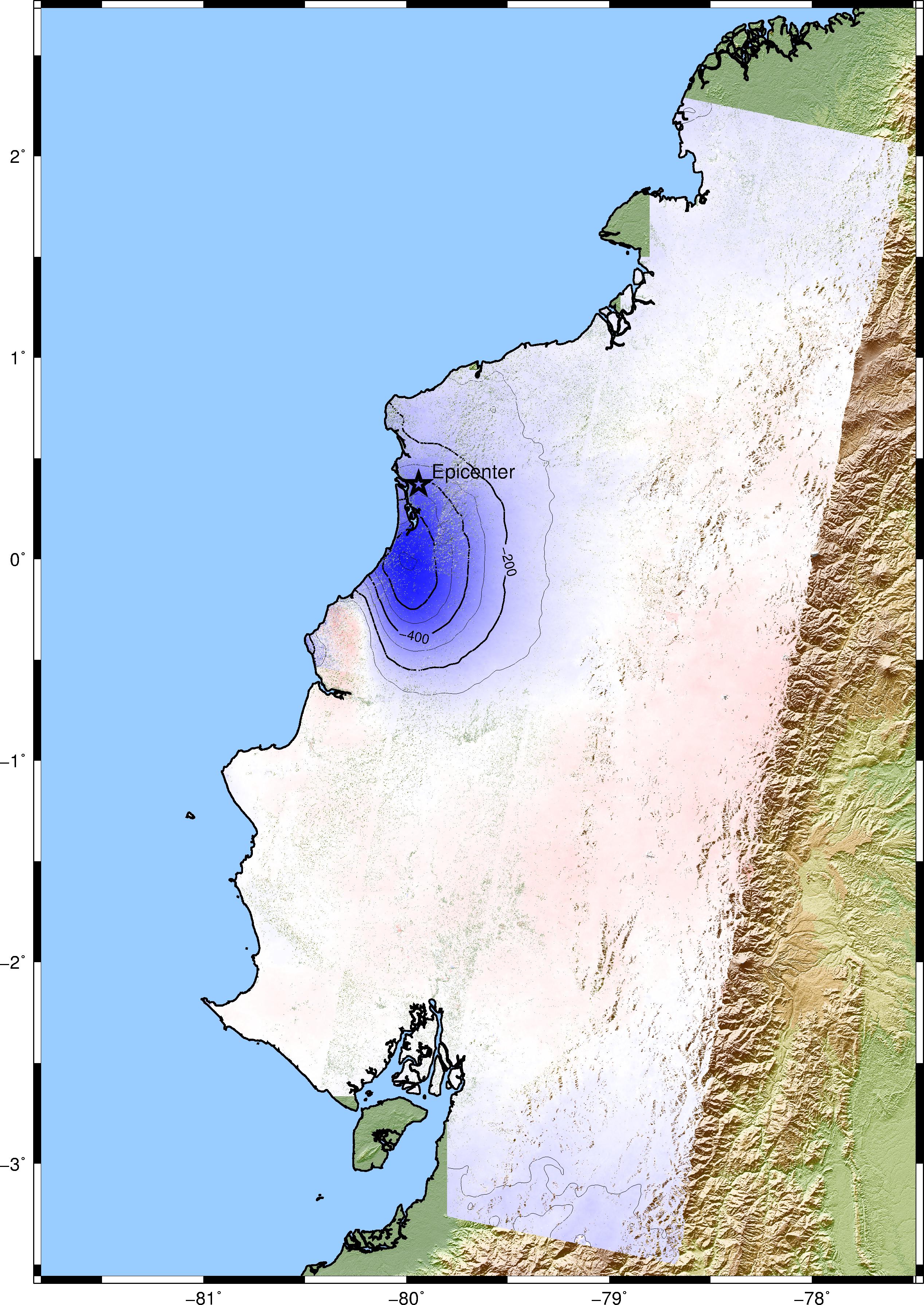
| The Mw 7.8 Ecuador
earthquake occurred on April 16, 2016 close to the
shoreline of north Ecuador. The background tectonics
shows a converging boundary between the young Nazca
plate and the Pacific plate (~61mm/yr USGS
report). By the time the earthquake struck, we are
lucky to have a few on-board satellites that acquired a
wealth of InSAR acquisitions. The C-band Sentinel-1A
satellite, operated by the European Space Agency (ESA), even though
severely affected by the thick ground vegetation,
managed to provide a 12-day coverage for the descending
track 40 and a 24-day coverage for the ascending track
18. The data are available on the Sentinel
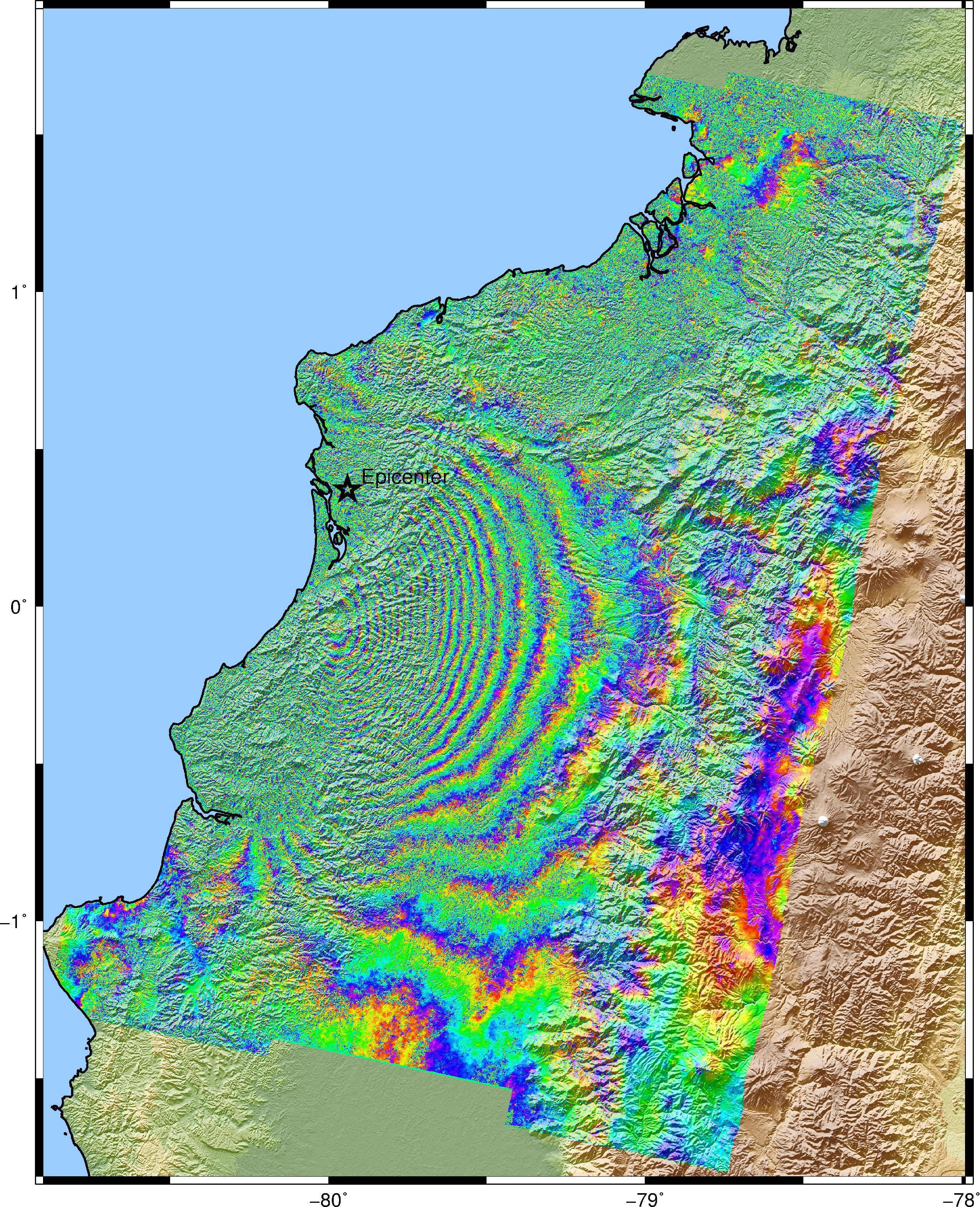
Datahub. The L-band ALOS-2 satellite, operated by
the Japanese Aerospace Exploration Agency (JAXA), collected
ScanSAR data for track 140 and the data can be found on
the ALOS-2
User Interface Gateway. This page is to
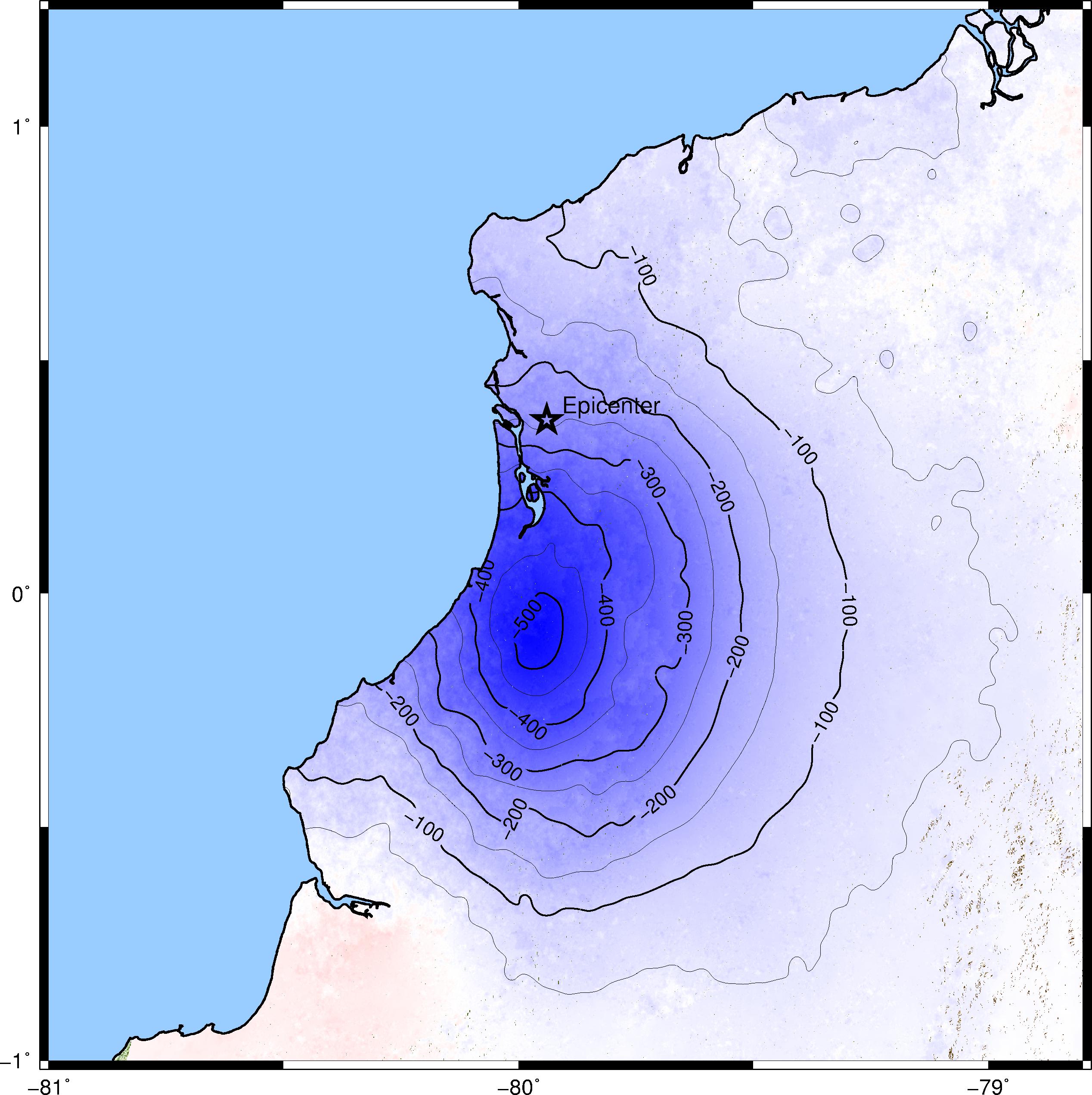
provide the extracted line-of-sight deformation data
from these 2 satellites and construct a elastic model
to reveal the down-dip of the rupture for this
subduction zone earthquake. We'll keep presenting
images for each track and update the line-of-sight
data once they are available. We'll also include KMZ
files for Google Earth. The InSAR data are processed
with an open source software GMT5SAR
and post processing are done with GMT and Matlab. The
InSAR phase are filtered with a 400m Gaussian filter.
The line-of-sight data are acquired by merging
different swaths' phase and then unwrapping using snaphu.
Then they are deramped with excluding the main shock
area in order to account for orbit error and
ionospheric effect. The line-of-sight (LOS) data also include a look vector pointing from the point on the ground to the position of the satellite. The data represent a block median average of the LOS in 0.01 degree bins. The format is: lon
lat
topo (m)
east
north up
los(mm)
sig(dummy) |
|
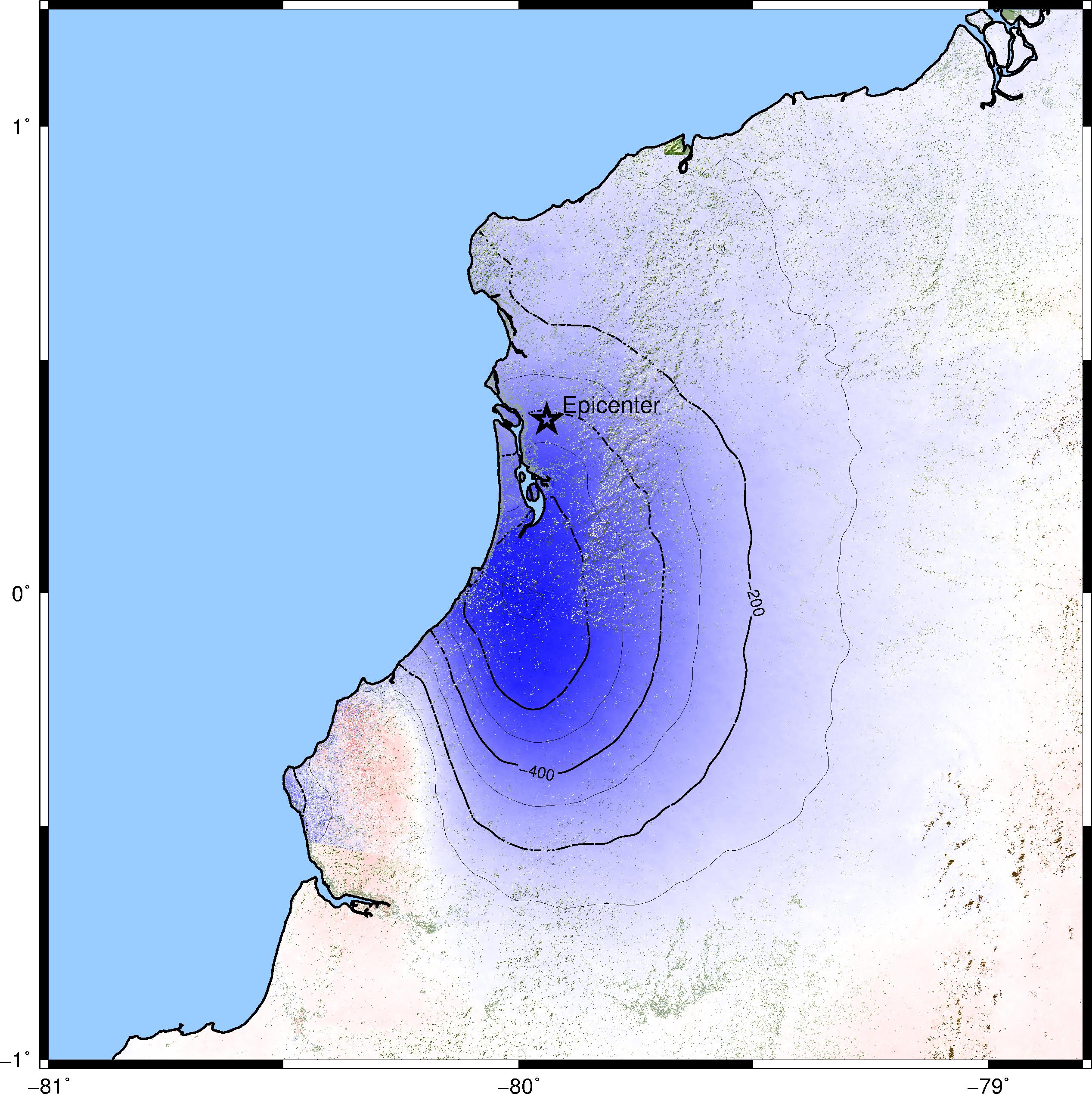
Sentinel-1A
TOPS mode Track 40
: 2016/04/12 - 2016/04/24
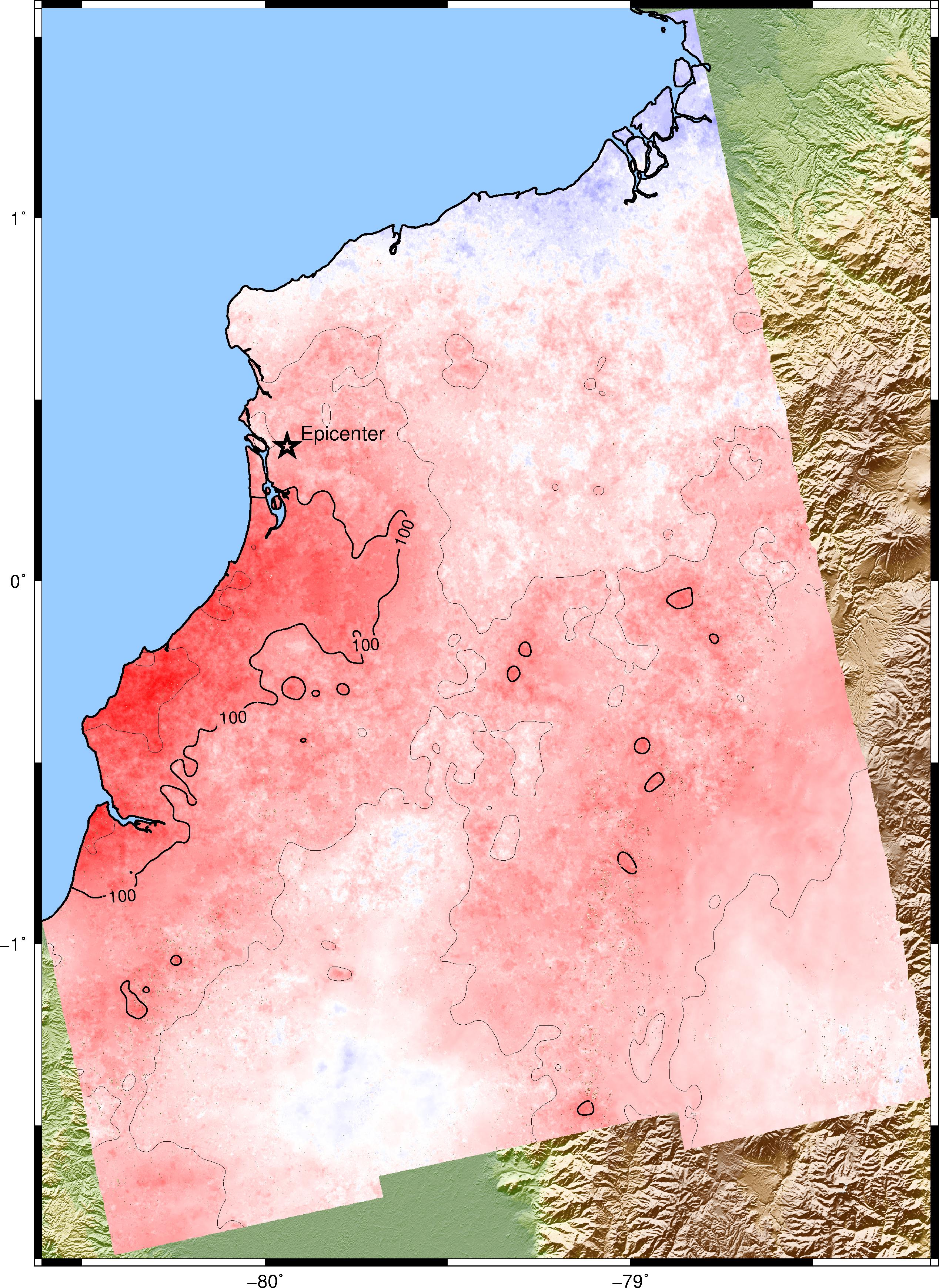
ALOS-2 ScanSAR
Track 140: 2016/04/01 - 2016/04/29
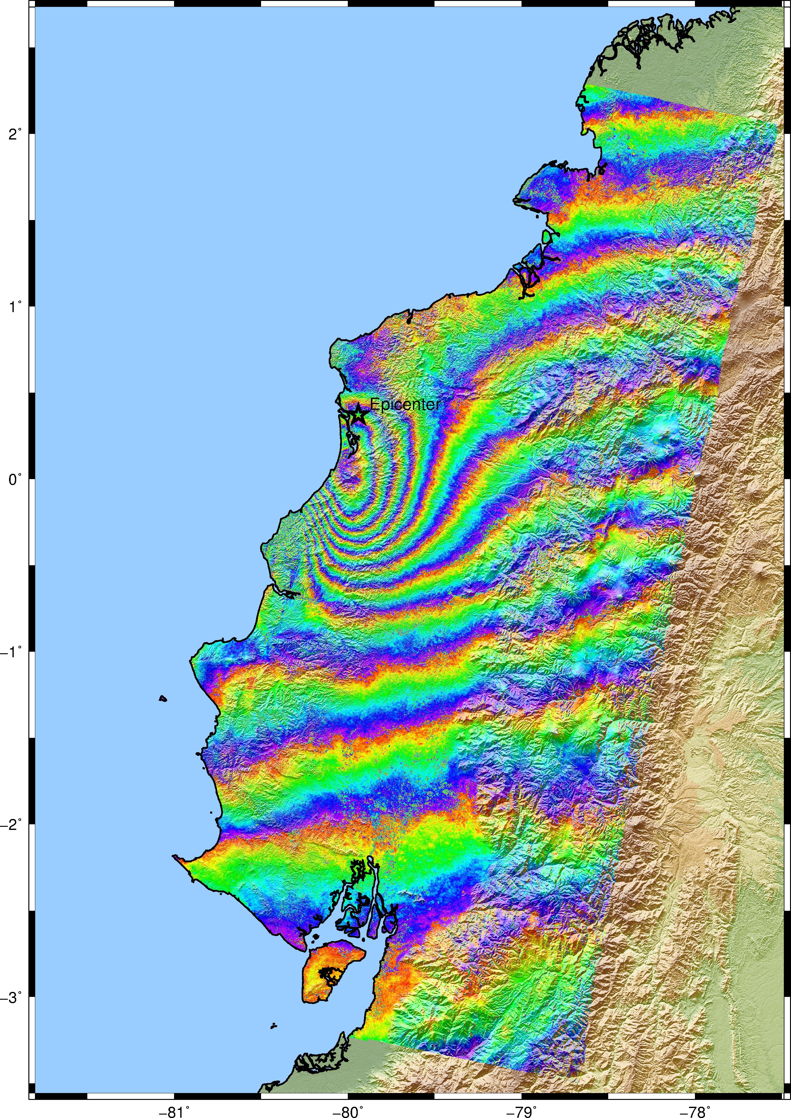
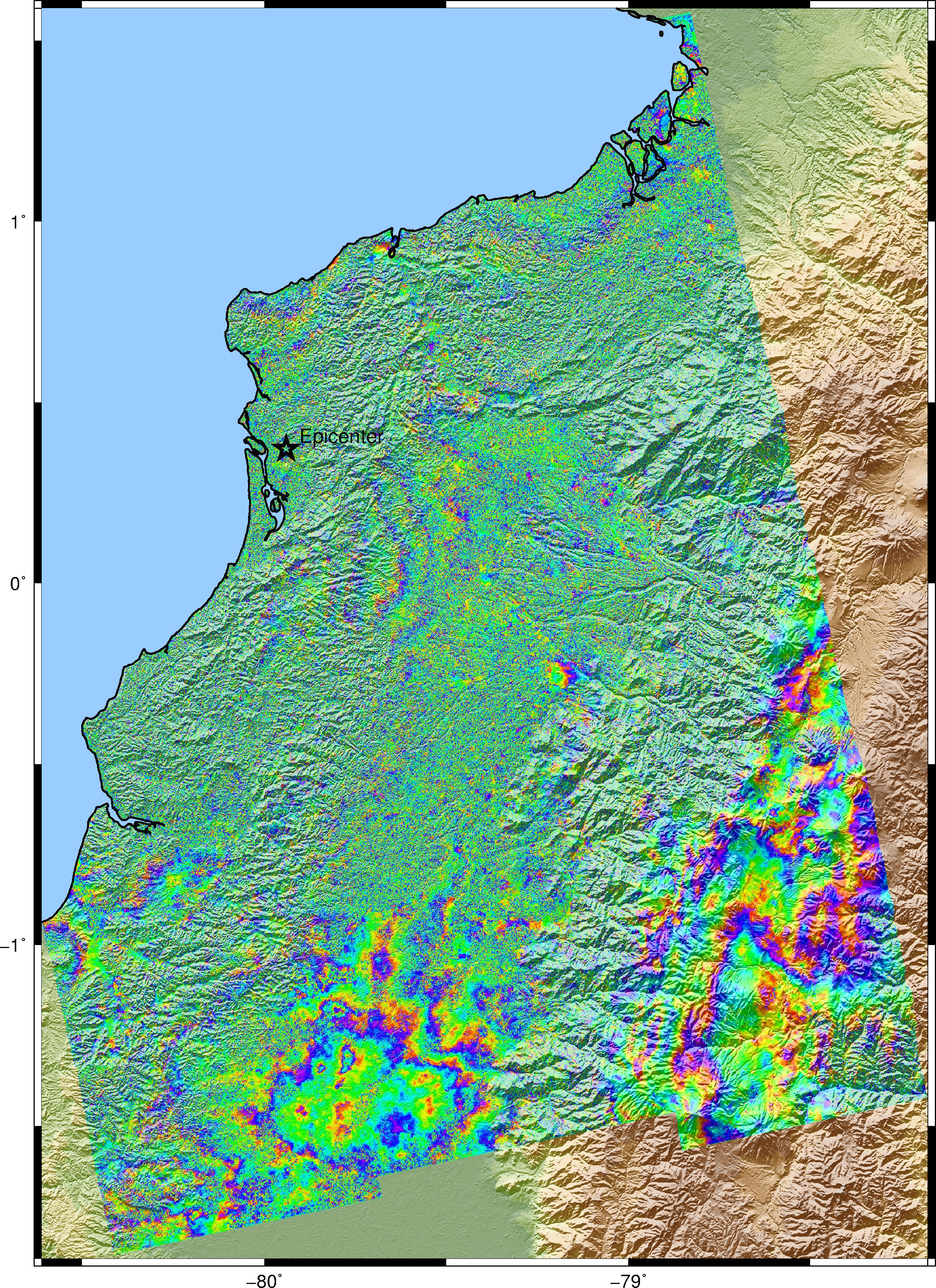
ALOS-2 StripMode Track 34: 2016/02/07 - 2016/05/01 (SM2 - SM3) 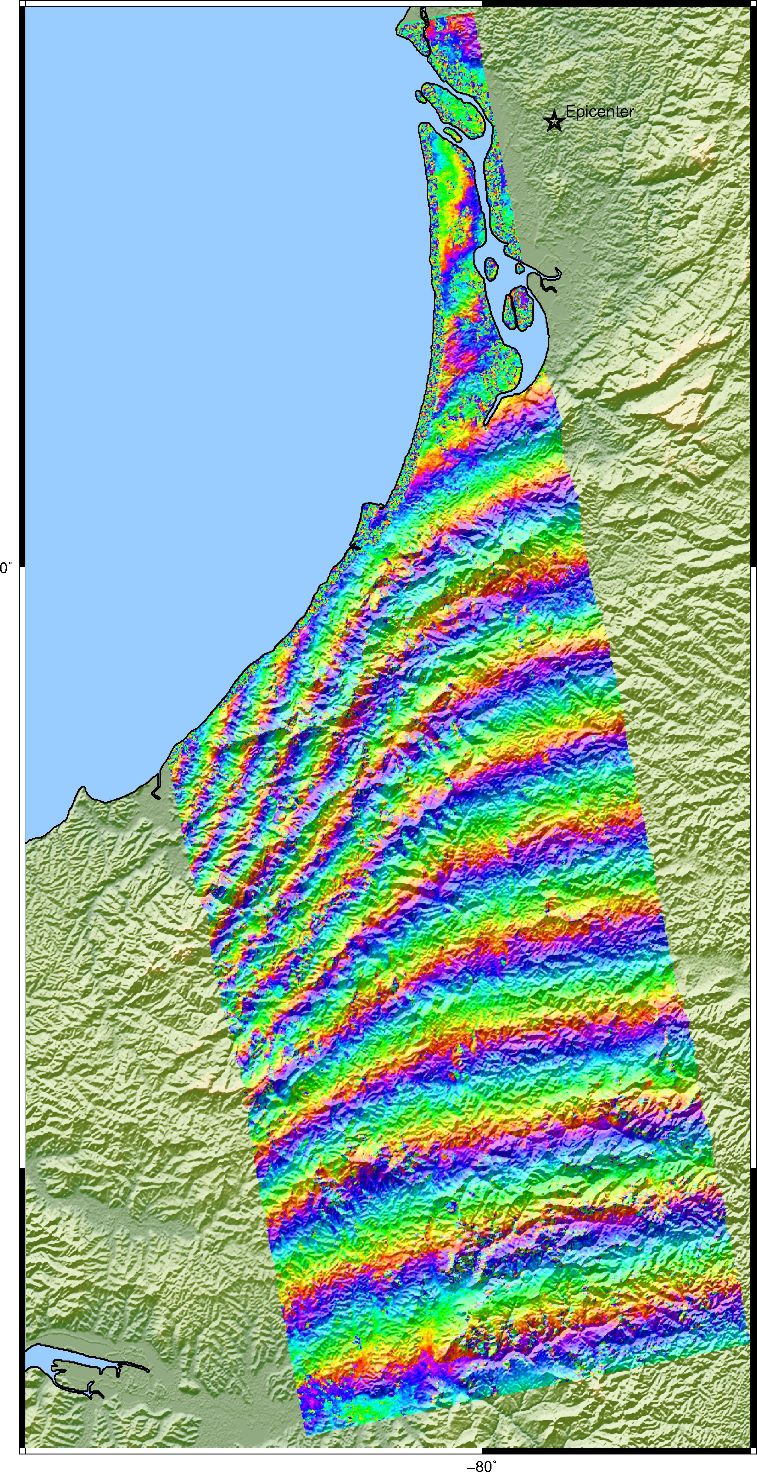 Phase LOS
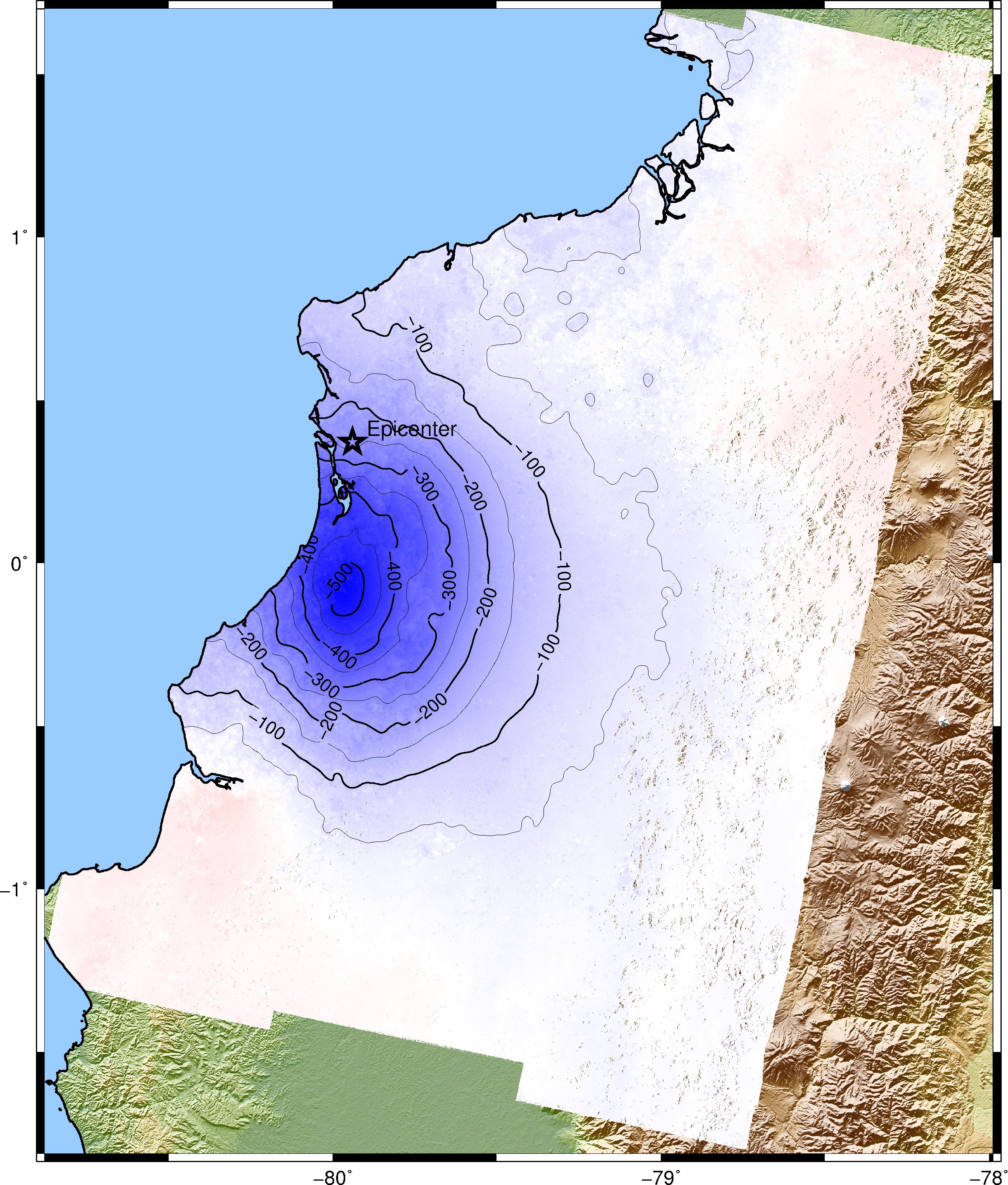
Sentinel-1A TOPS mode Track 18: 2016/03/29 -
2016/04/22
|