|
- InSAR data:
original LOS displacement at 500 m
resolution and
downsampled detrended LOS displacement
- Surface Fracture data:
KMZ file - High passed East-West data: KMZ file
- High passed Up-Down/South-North data: KMZ file
- Slip model and a Matlab plotting script:
Download - kmz files for Google Earth:
Surface deformation models (East-West,
North-South,and Vertical) - kmz-files for Google Earth:
Coulomb Stress Change - kmz-files for Google Earth:
Phase
LOS
Phase Gradient X
Phase Gradient Y - kmz-files for Google Earth:
Phase
LOS
Phase Gradient X
Phase Gradient Y - kmz-files for Google Earth:
Phase
LOS Multi-Aperture
Interferogram - kmz-files for Google Earth:
Phase
LOS Multi-Aperture
Interferogram
M7.1 Ridgecrest Earthquake:Line of
sight displacement revealed by
Sentinel-1 and ALOS-2 Interferometry
Data
manuscript published on
Seismological Research Letters
2019
Model
and Fracture mechanism manuscript
published in Science 2020
Xiaohua Xu1, David Sandwell1,
Bridget Smith-Konter2,
1Institute for Geophysics
and Planetary Physics, University of
California, San Diego, USA
2Department of Earth
Sciences, University of Hawaii at
Manoa, Honolulu, USA
![]()
![]()
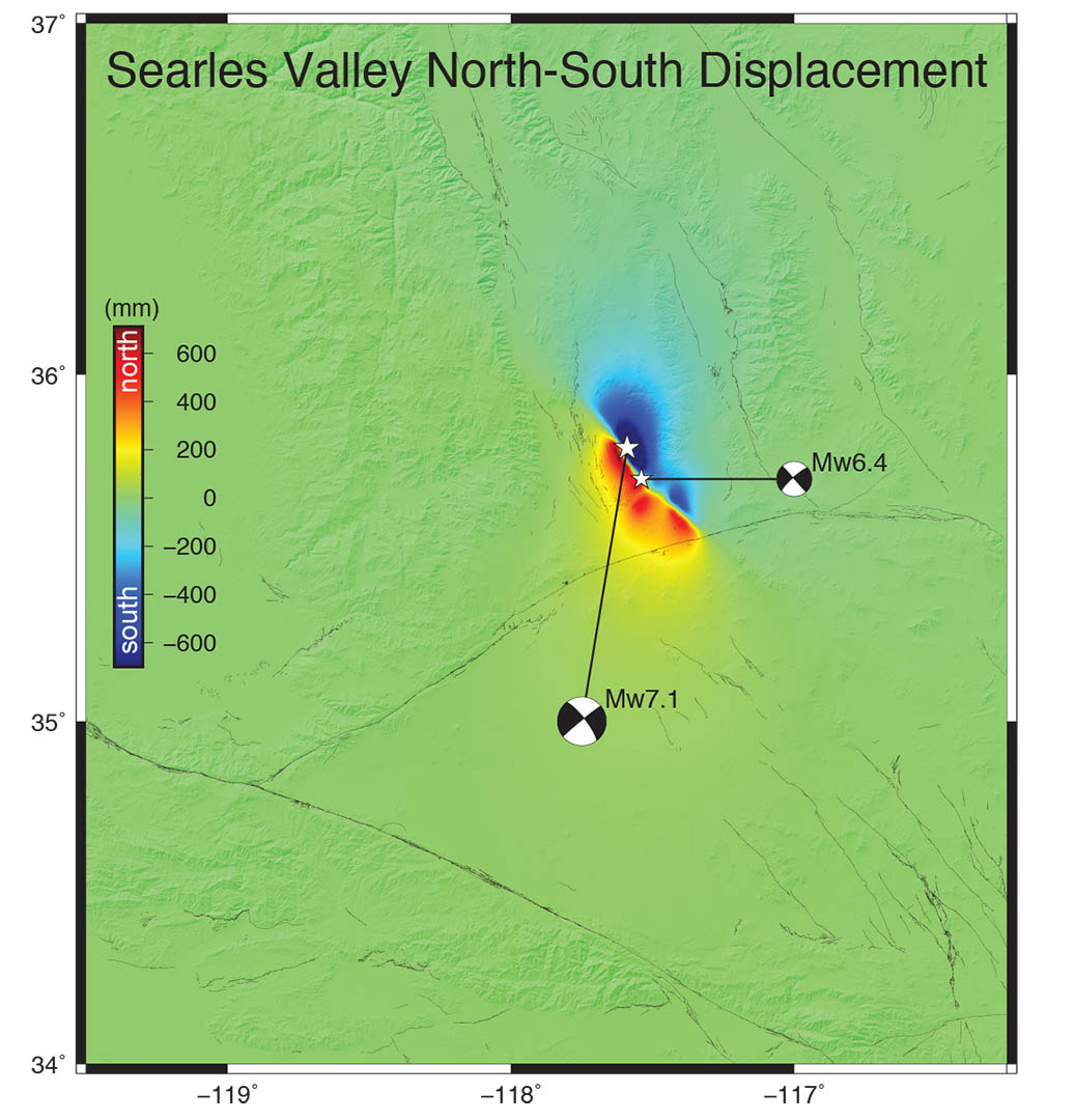
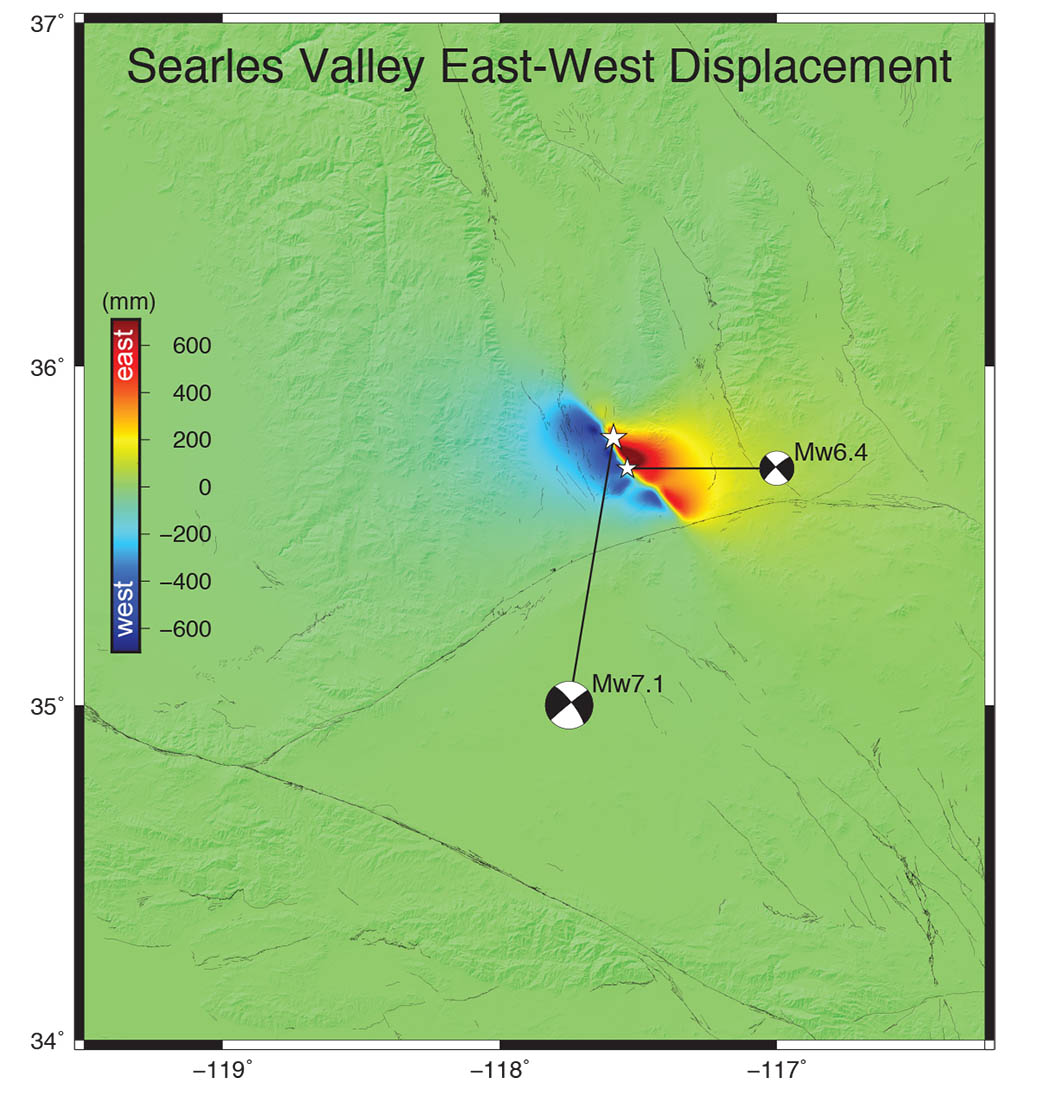
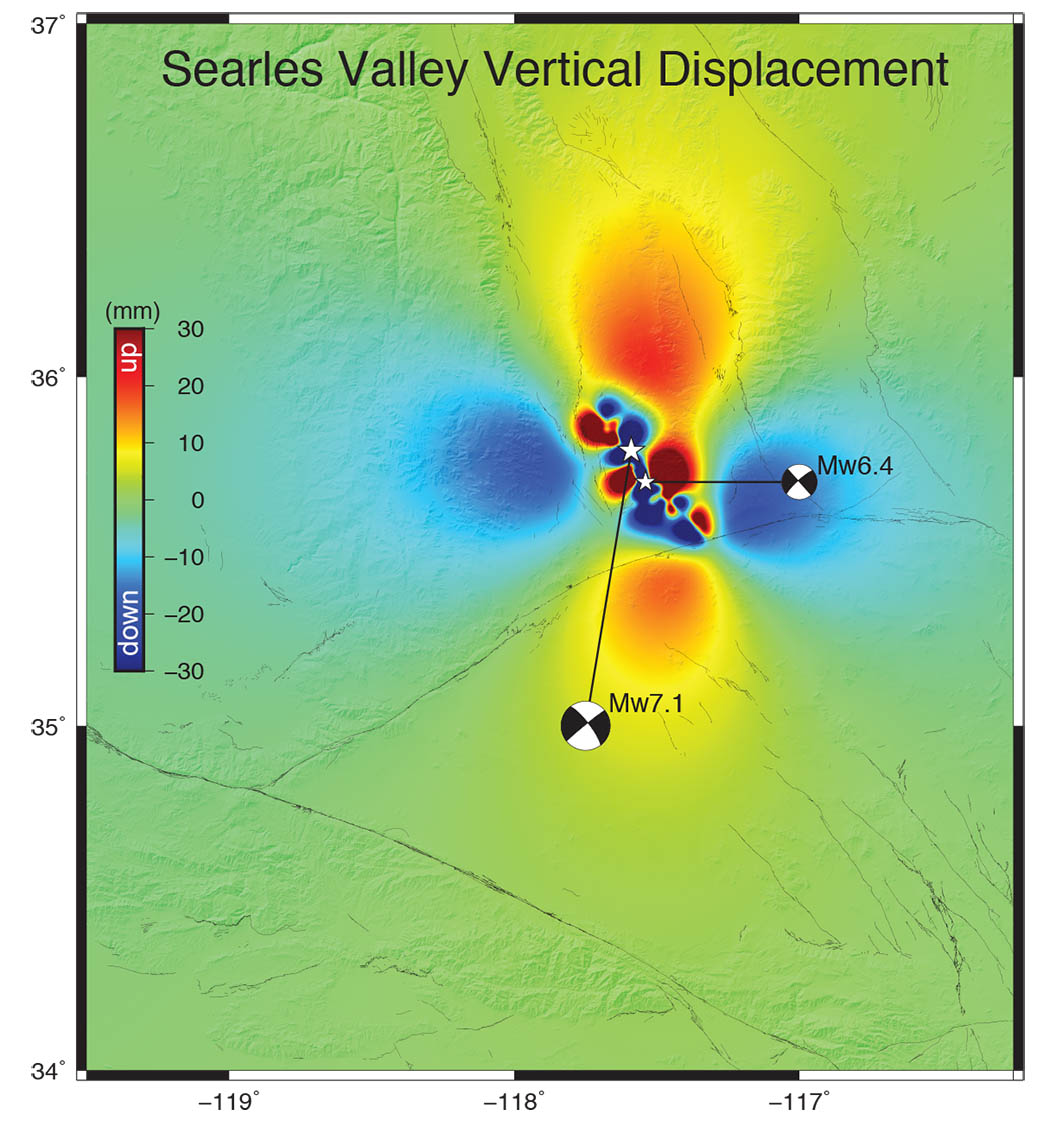
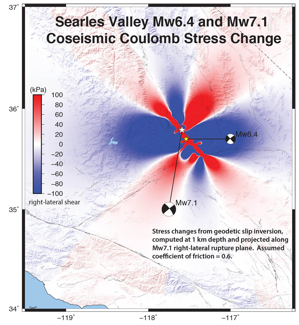
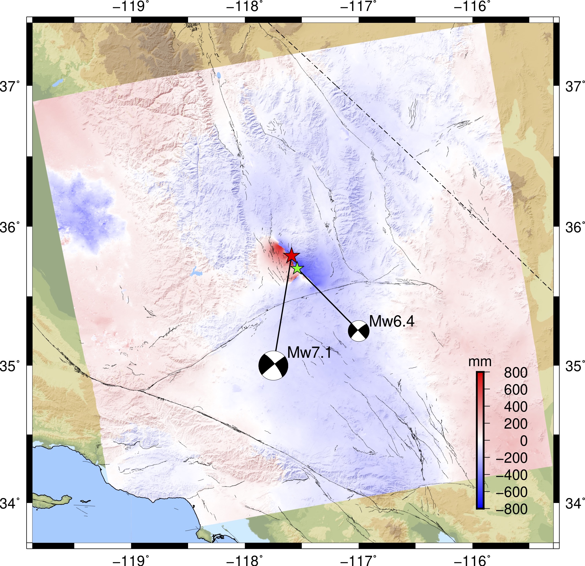
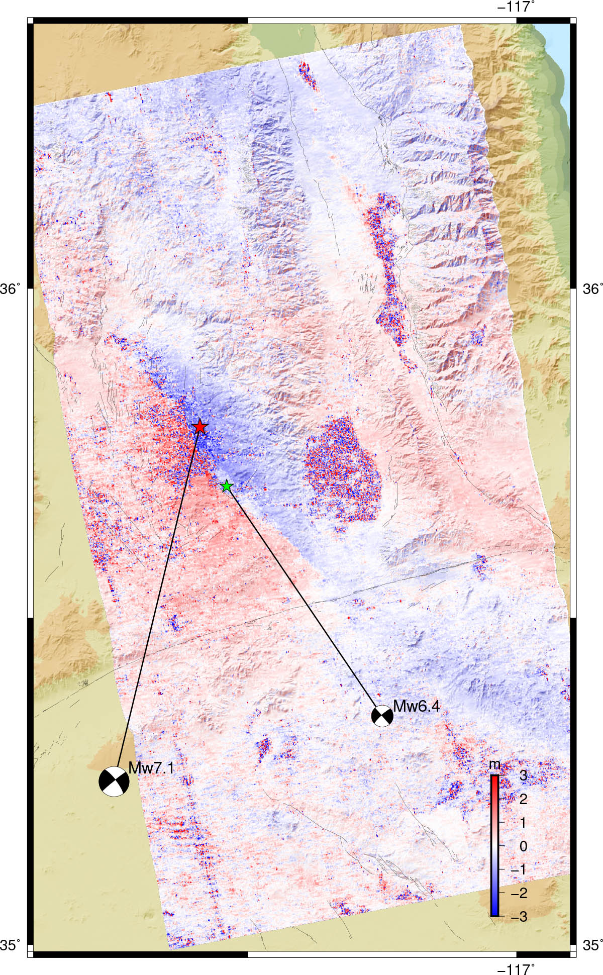
The Mw7.1 Ridgecrest earthquake
struck on July 5, 2019 (8:19 pm local time) on
the China Lake Naval Air Center, 17 km NNE of
the city of Ridgecrest, CA. 36 hours prior, on
July 4, 2019, a Mw6.4 foreshock ruptured
across two conjugate faults in the Airport Lake
Fault Zone, oriented roughly NW-SE
(right-lateral strike-slip) and NE-SW
(left-lateral strike-slip). The Mw7.1 event
(right-lateral strike-slip) re-ruptured the
NW-trending fault of the Mw6.4 event and also
extended the rupture both to the NW and SE to at
least 50 km. Field scientists report
observations of 2-3 meters of right-lateral
offset along the Mw7.1 rupture.
Two InSAR satellites were operational before the
earthquake and continue to collect measurements
of line-of-sight (LOS) deformation. The C-band
Sentinel-1 satellites, operated by the European
Space Agency (ESA), provide a 6-day
coverage (ascending and descending tracks) of
the earthquake sequence. These data are
available on the Sentinel Data Hub. The
L-band ALOS-2 satellite, operated by the
Japanese Aerospace Exploration Agency (JAXA),
collected ascending ScanSAR data for track 065
and the data can be found on the
ALOS-2 User Interface Gateway.
This page is to provide near-real time
line-of-sight deformation data from Sentinel-1
and ALOS-2. We will continue to provide images
for each repeat pass and update the
line-of-sight data once they are available. We
also include KMZ files for Google Earth. The
InSAR data are processed with open source
software GMTSAR
and mapped using Generic Mapping Tools (GMT).
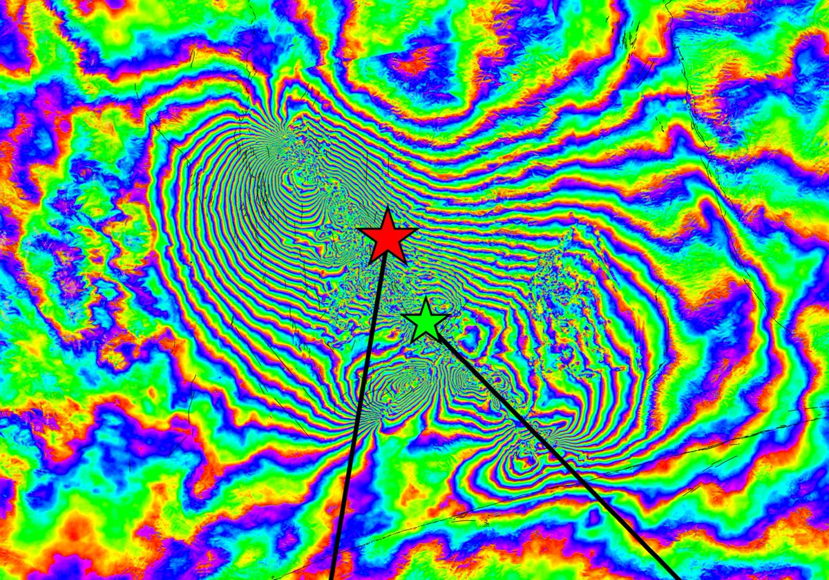
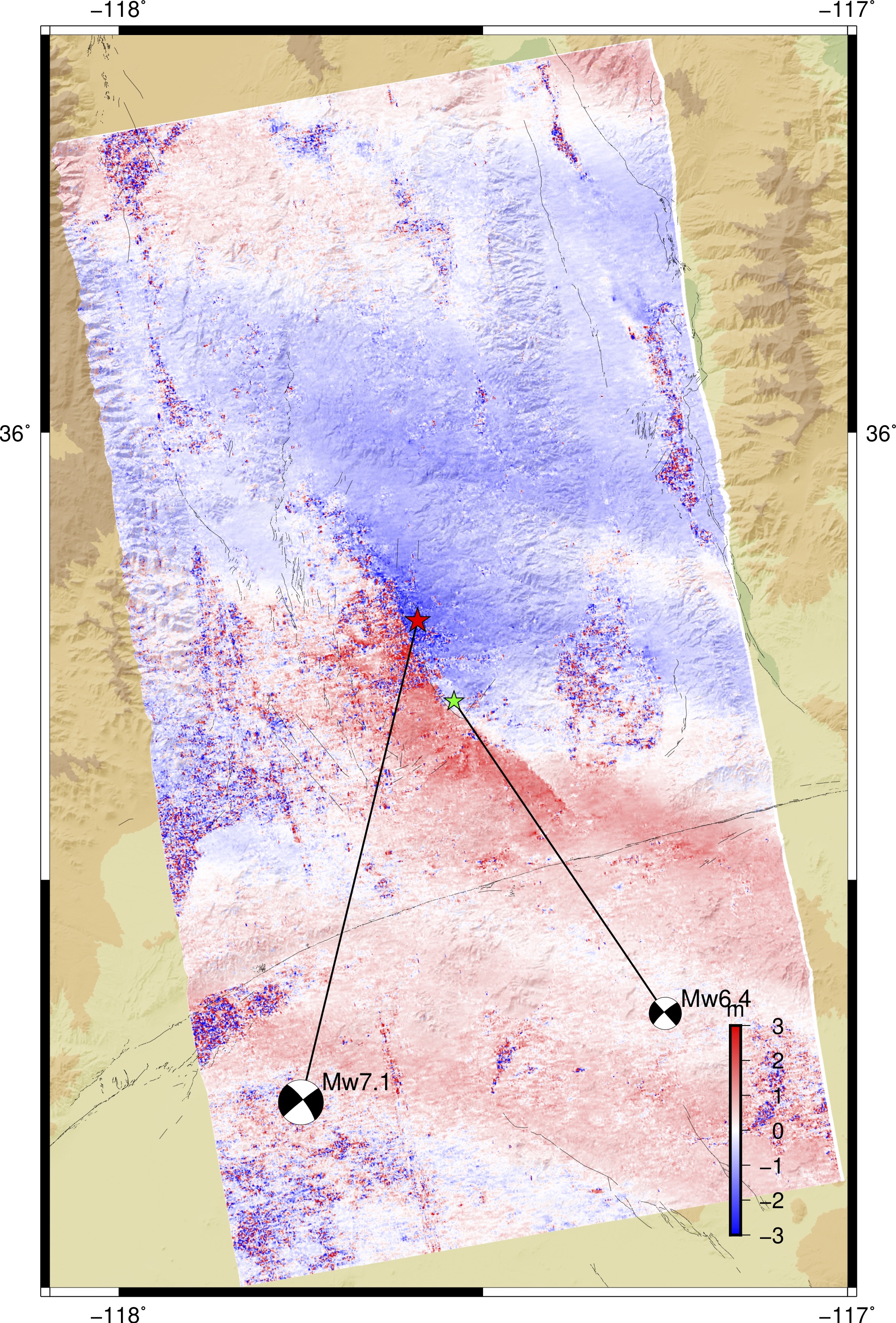
The InSAR phase are filtered with a 100 m
Gaussian filter. The line-of-sight data are
acquired by merging different swaths' phase and
then unwrapped using snaphu. We also provide a
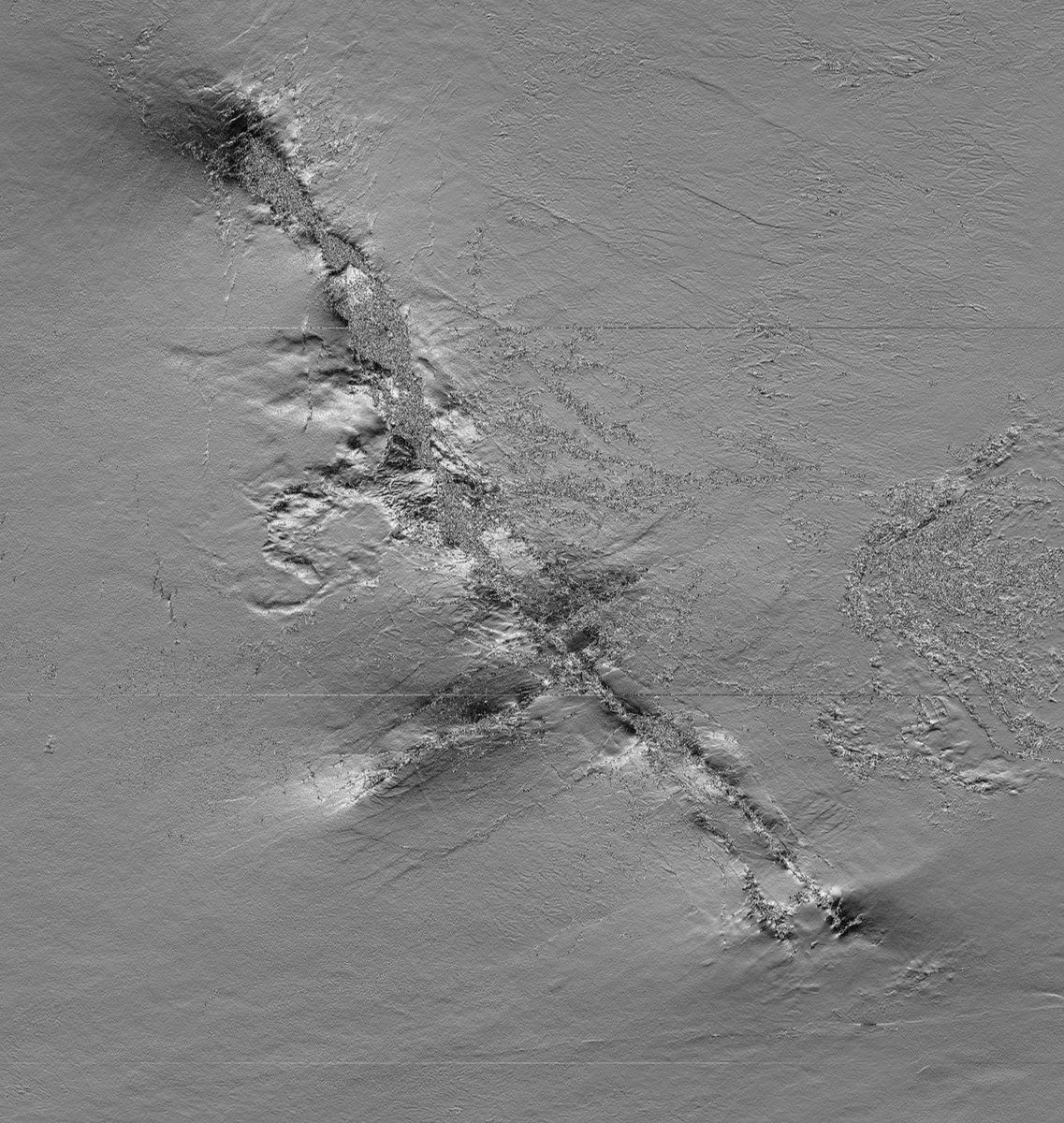
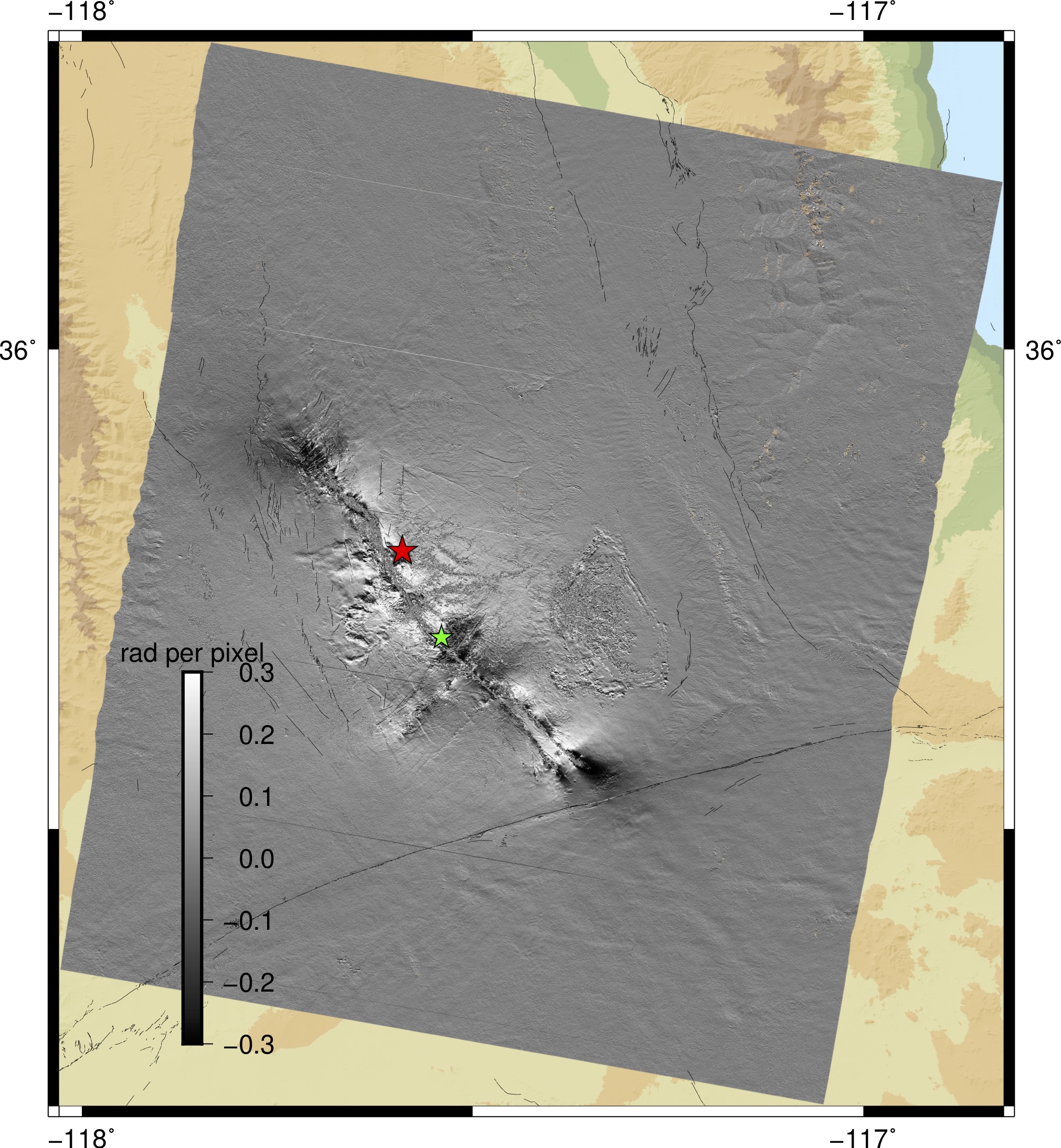
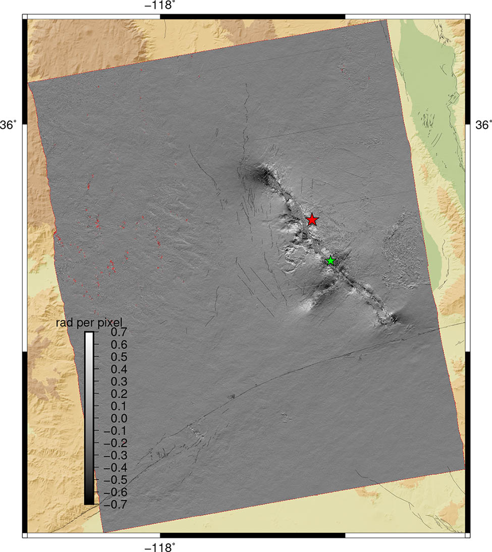
higher resolution product of the immediate
rupture area with range phase gradient also
computed to highlight the surface fractures.
Displacement due to both the Mw6.4 (July 4,
2019) and the Mw7.1(July 5, 2019) Ridgecrest
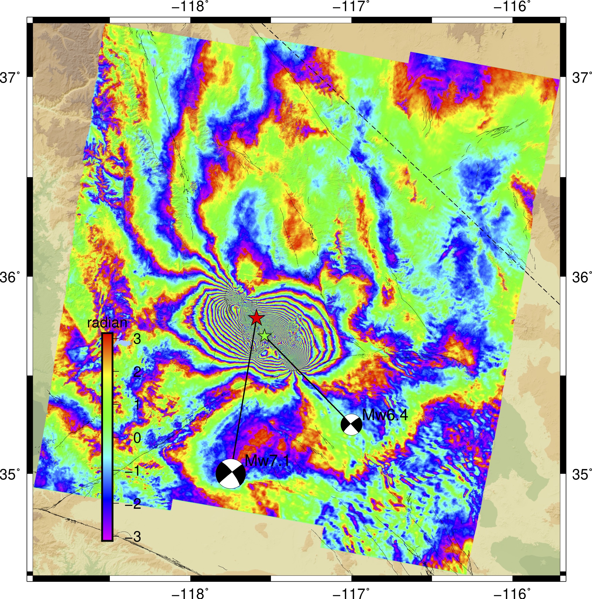
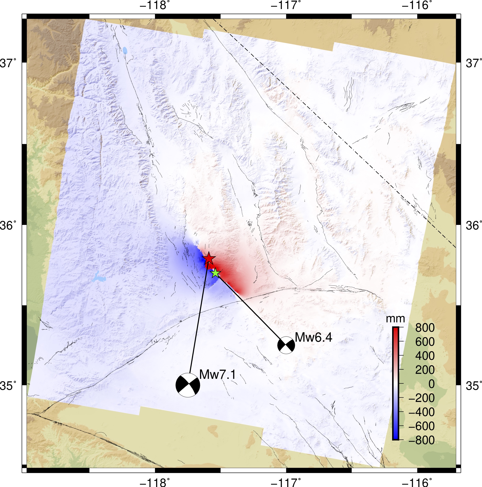
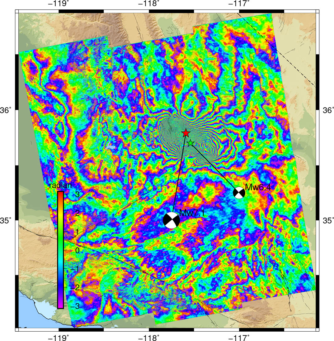
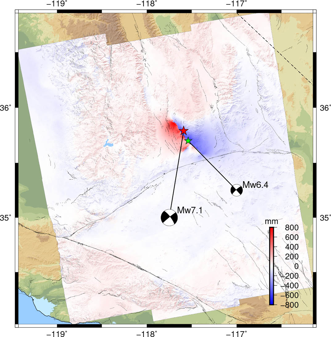
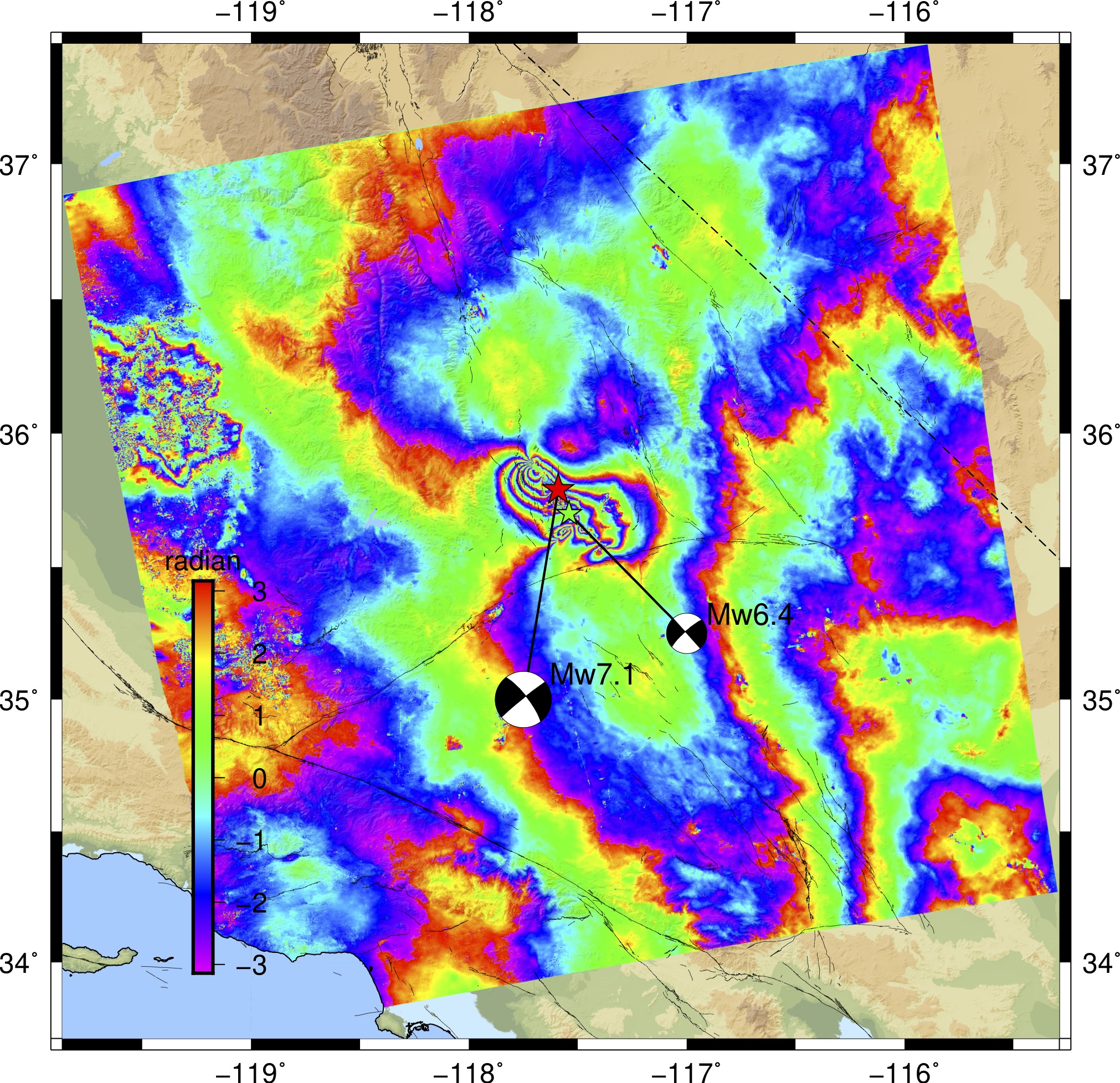
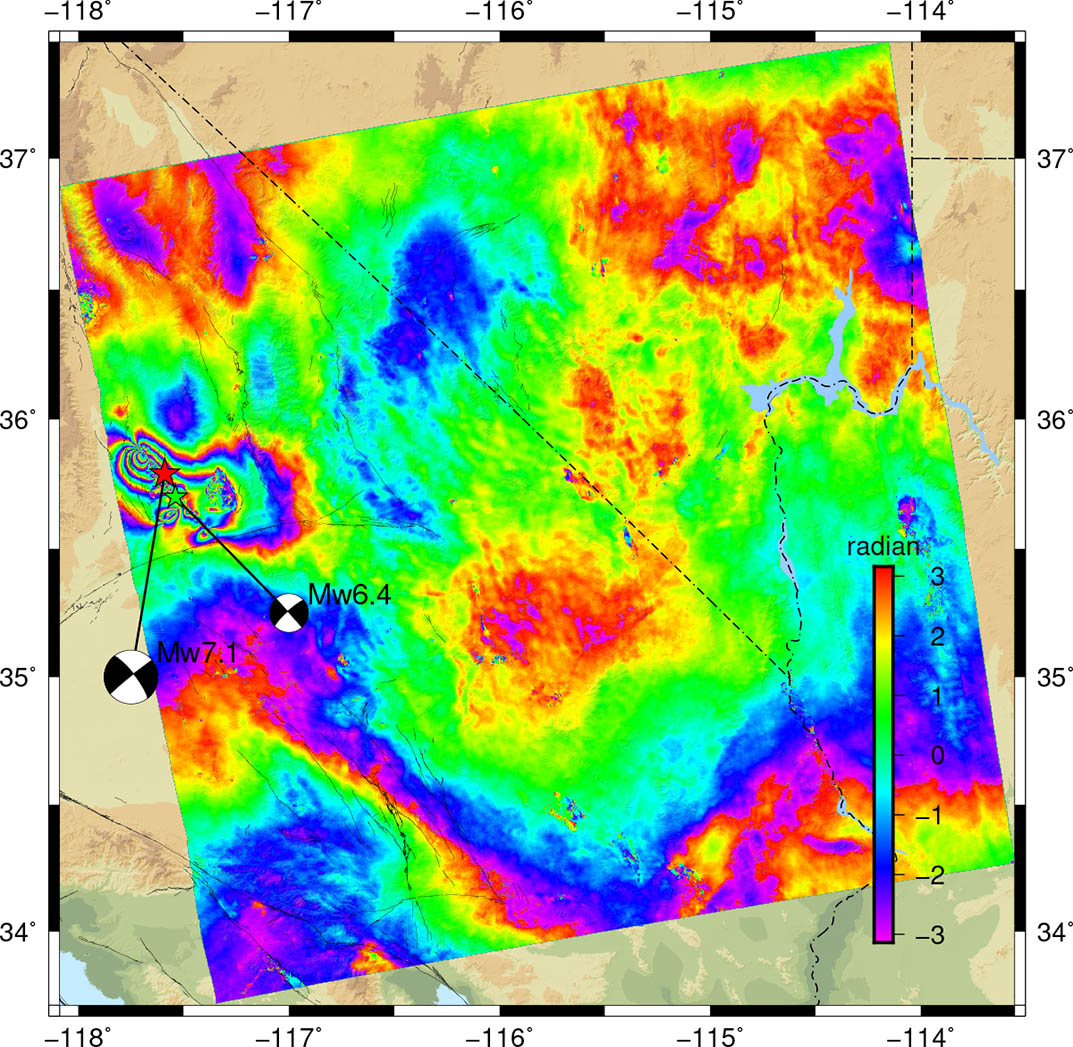
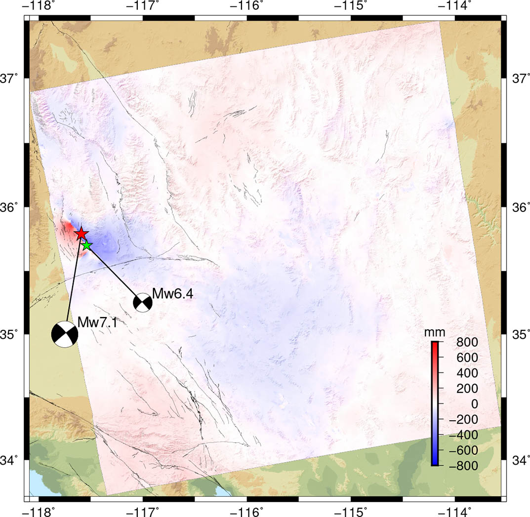
earthquakes are observed. Both wrapped
interferograms and line-of-sight (LOS)
displacement maps are provided below. For the
Sentinel-1 interferogram maps, each fringe
represents 2.8 cm of ground displacement away
from the satellite. For the ALOS-2 maps, each
fringe represents 12 cm of ground displacement.
For ascending LOS maps, red colors (positive)
indicate motion toward the satellite (up or
west) and blue colors (negative) indicate motion
away from the satellite (down or east). For
descending LOS maps, red colors (positive)
indicate motion again toward the satellite but
now up or east, and blue colors (negative)
indicate motion down or west.
Processed InSAR data for Modelers:
data format is: #lon #lat #elevation(m)
#loos_E(cosine) #look_N(cosine) #look_U(cosine)
#displacement(mm) #error(-1)
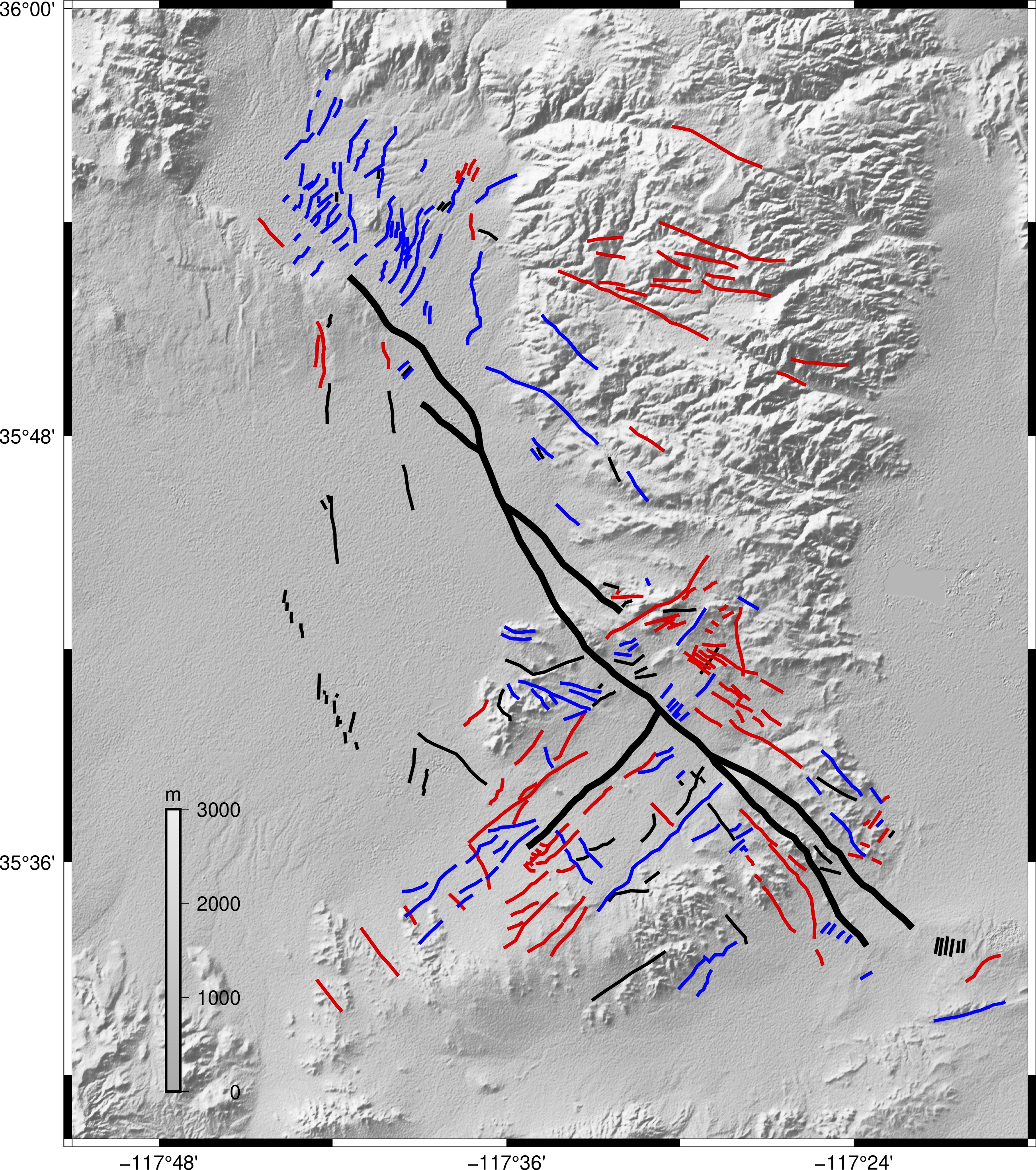
Fracture map: Red - right lateral; Blue -
Left lateral; Black - rupture or unknown

Slip model files:
Preliminary Fault Slip and Surface
Deformation Models
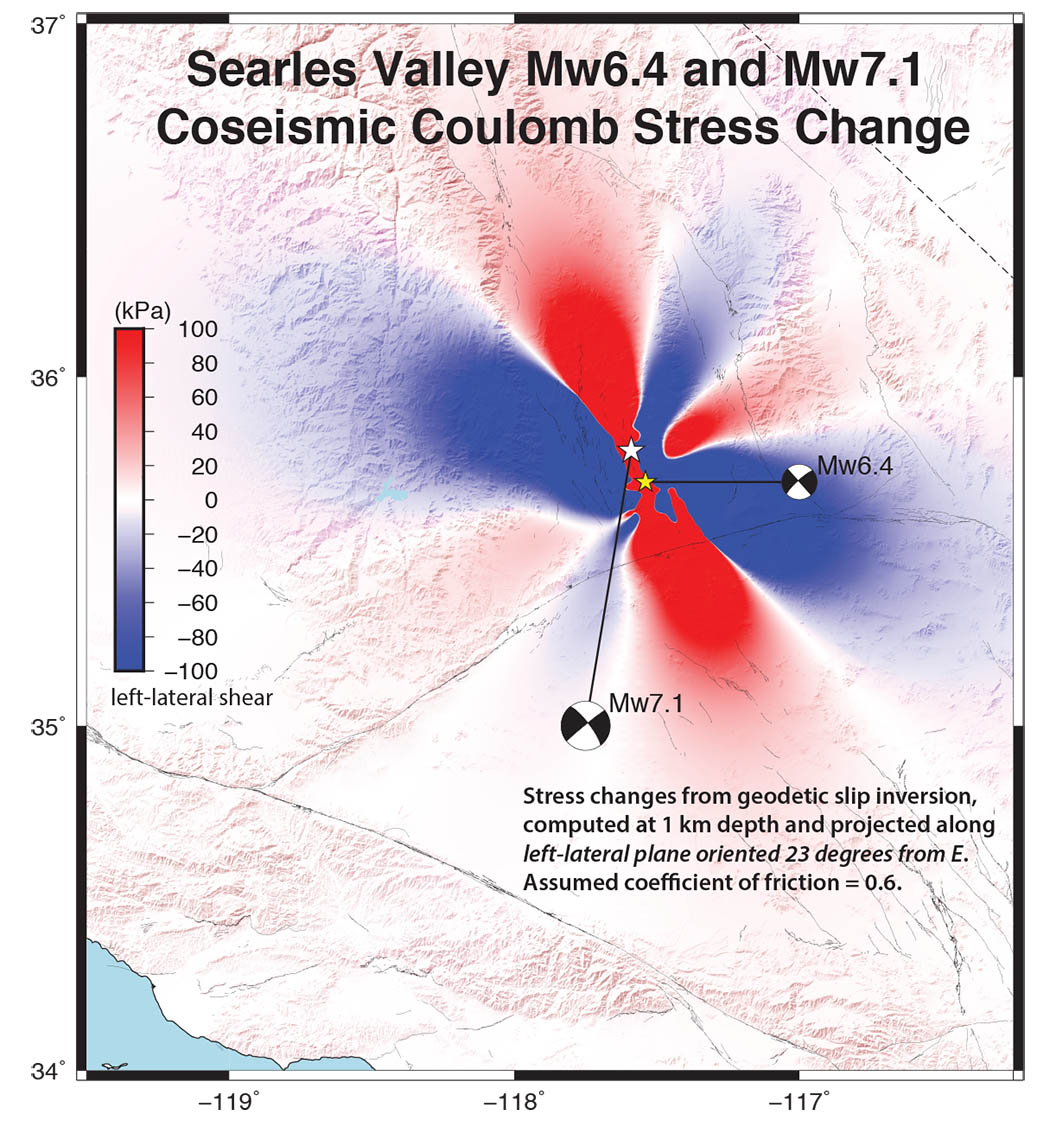
Slip inversion uses 3 component GPS (by
Peng), Sentinel-1, ALOS-2, and optical imagery
fault offset (by Milliner).
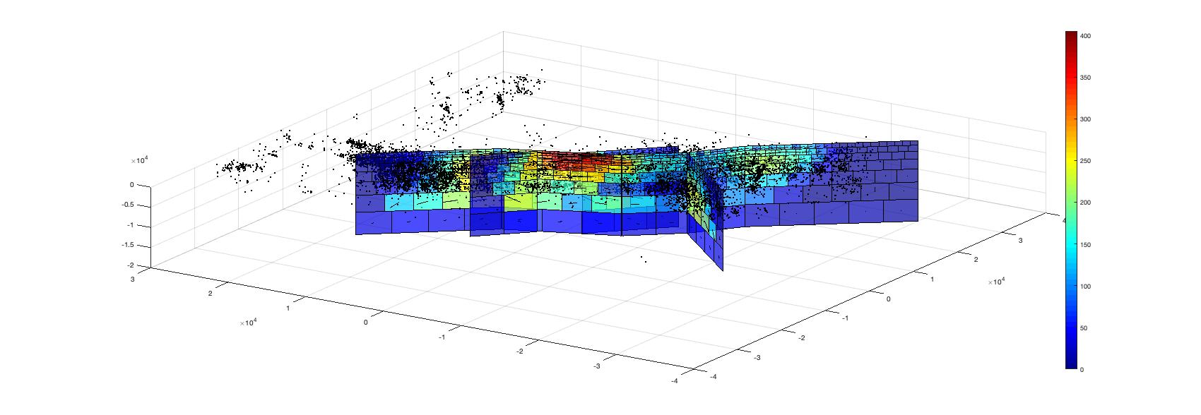
Preliminary Coulomb Stress Change Model

Sentinel-1 Descending track T71: 2019/07/04
- 2019/07/16
Sentinel-1 Ascending track T64: 2019/07/04 -
2019/07/10
ALOS-2 Ascending track T66: 2017/08/12 -
2019/07/13
- note the MAI interferogram need to be
corrected for ionosphere related azimuth shift
before use, see Liang & Fielding (2017) for
details.
ALOS-2 Ascending track T65: 2016/08/08 -
2019/07/08
Acknowledgements:
We thank ESA and JAXA for the rapid acquisition
and distribution of their data. The development
of the GMTSAR software, especially the
processing chain for Sentinel-1 and ALOS-2, was
supported by NASA and the National Science
Foundation through the NASA Earth Surface and
Interior program (NNX16AK93G and 80NSSC19K1043),
the NSF Office of Advanced Cyberinfrastructure
program (OAC-1834807), and the NSF EarthScope
program (EAR-1147435, EAR-1424374, EAR-1614875).