Generate InSAR time series for your area of interest
Enter the center longitude and latitude for the area of your interest. Hit generate to get the Sentinel-1 A/B
InSAR time-series. This product is done using Sentinel-1 TOPS data and GNSS weekly solutions provided by SOPAC.
The LOS velocity and velocity uncertainty is estimated using linear regression on the time-series. The semi-vertical
component is done by subtracting a horizontal GPS velocity model (Zeng & Shen, 2017) from the Descending LOS time-series.
Please check on the map first to find whether your area of interest is available.
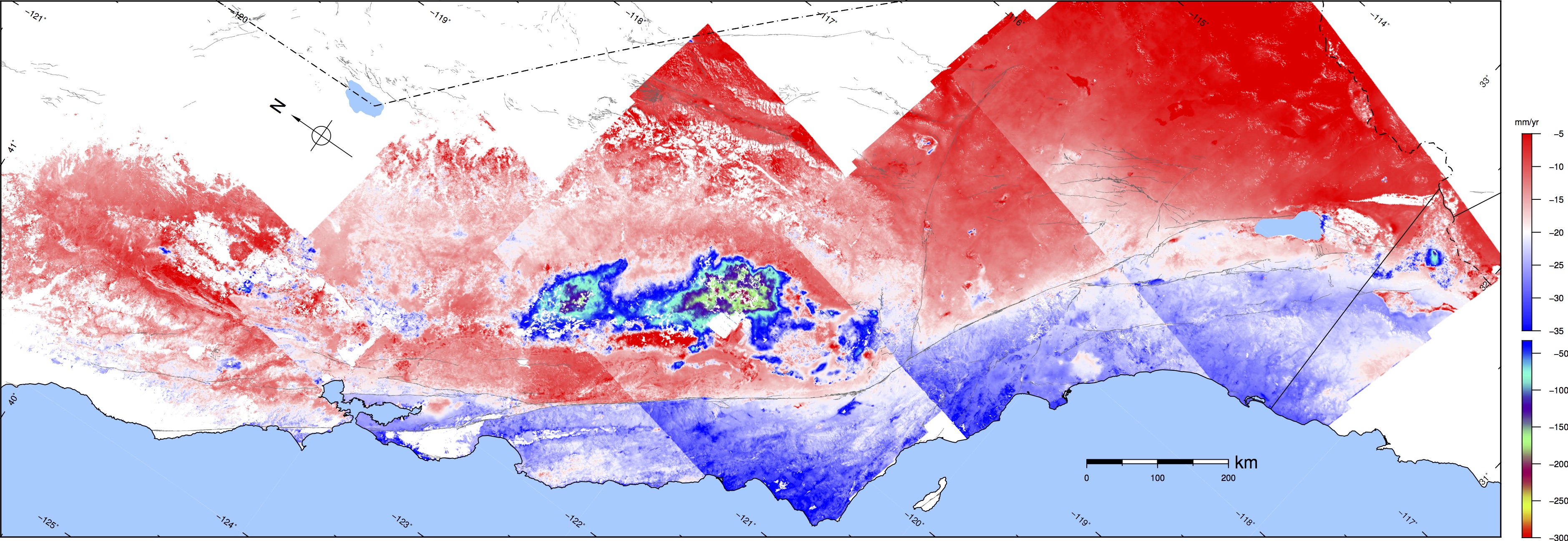
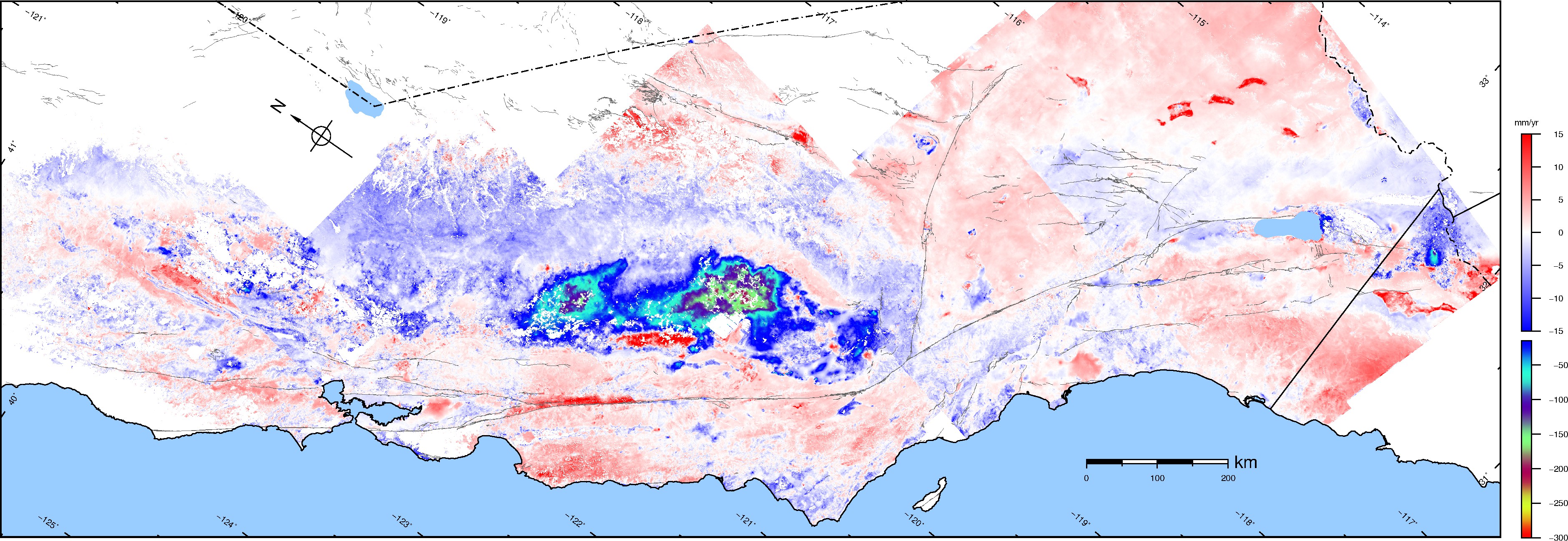
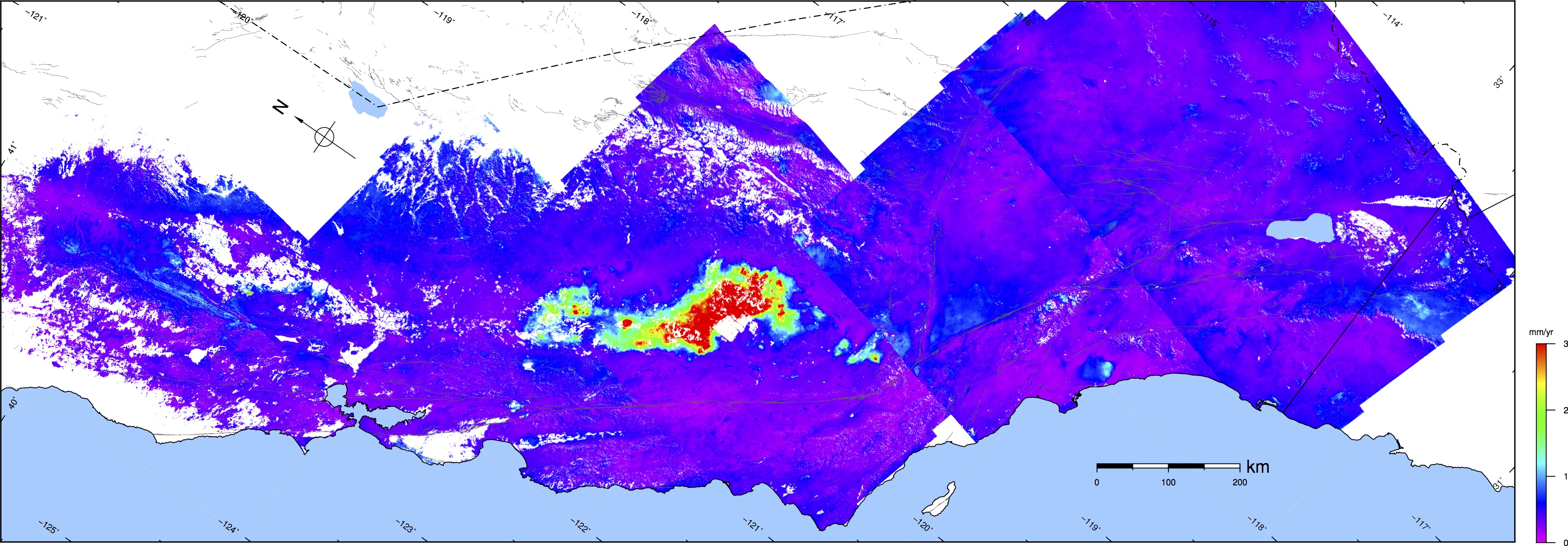
Line-of-Sight Velocity Maps from Sentinel-1A/B InSAR![]()
Citation: Xu, X., Sandwell, D. T., Klein, E., & Bock, Y. (2021). Integrated Sentinel‐1 InSAR and GNSS Time‐Series Along the San Andreas Fault System. Journal of Geophysical Research: Solid Earth, 126(11), e2021JB022579.
This process is not very fast (a few minutes) so please be
patient. When it is done hit "Download" below.