|
|||
|
|
|||
|
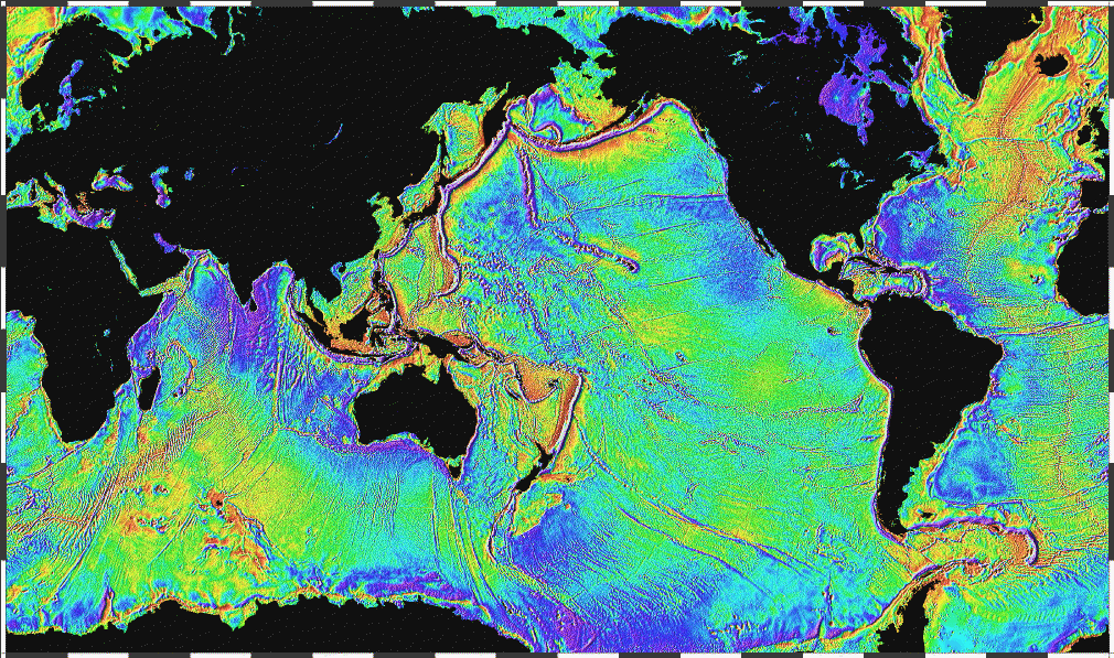
SRTM30_PLUS: SRTM30, COASTAL & RIDGE MULTIBEAM, ESTIMATED TOPOGRAPHYNEW! Get ASCII XYZ-file, region V6.0 December 2, 2009 NEW! FTP SRTM30_PLUS, entire grid V6.0 November 28, 2009 OLD! SRTM30_PLUS Bathymetry used in Google Earth V5.0 and Google Maps February 2, 2008 Reference, gravity data: Sandwell, D. T., and W. H. F. Smith, Global marine gravity from retracked Geosat and ERS-1 altimetry: Ridge Segmentation versus spreading rate, J. Geophys. Res., 114, B01411, doi:10.1029/2008JB006008, 2009 This data consists of 33 files of global topography in the same format as the SRTM30 products distributed by the USGS EROS data center. The grid resolution is 30 second which is roughly one kilometer. In addition the global data are also available in a single large file ready for GMT. Land data are based on the 1-km averages of topography derived from the USGS SRTM30 grided DEM data product created with data from the NASA Shuttle Radar Topography Mission. GTOPO30 data are used for high latitudes where SRTM data are not available. Ocean data are based on the Smith and Sandwell global 1-minute grid between latitudes +/- 81 degrees. Higher resolution grids have been added from the LDEO Ridge Multibeam Synthesis Project, the JAMSTEC Data Site for Research Cruises, and the NGDC Coastal Relief Model. Arctic bathymetry is from the International Bathymetric Chart of the Oceans (IBCAO) [Jakobsson et al., 2003]. The pixel-registered data are stored in 33 files with names corresponding to the upper left corner of the array shown below. The data are also merged into a single large (1.9 Gbyte, 2-byte integer) file as well as smaller 1-minute and 2-minute netcdf versions. Matching files of source identification number are available for determining the data source for every pixel. Quick Contents:Interactive MapsThe map below has been sectioned into 33 clickable regions. Clicking on a particular region will open a new window showing the zoomed in region in more detail. Related SitesALL MARINE BATHYMETRY DATA ARE WELCOME!If you would like to contribute data to the next version of the global topography grid we would be pleased to use it. Any format is welcome, even raw multibeam formats. If it does not fit into the following anonymous ftp site then send me an e-mail and I'll find another place for it. dsandwell@ucsd.edu ftp topex.ucsd.edu |
|
|
|
HOME |
BACKGROUND |
PEOPLE |
GLOBAL TOPOGRAPHY |
RADAR ALTIMETRY |
SYNTHETIC APERTURE RADAR |
LINKS |
CONTACT
|
|||