
 |
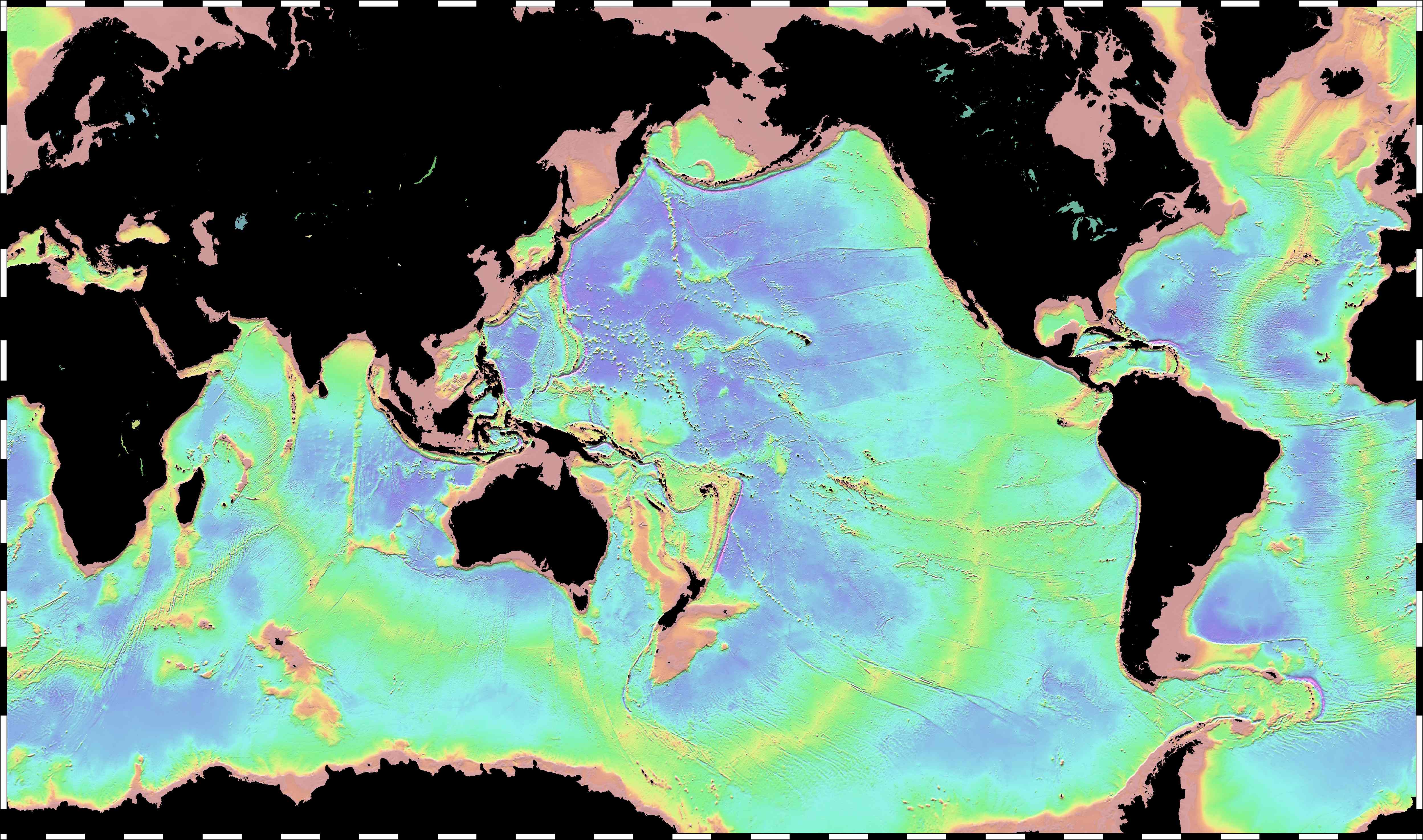
MEASURED AND ESTIMATED SEAFLOOR TOPOGRAPHY
SYNBATH V2.0 August 14, 2024
SRTM15+ V2.7 April 21, 2025
Global Topography V27.1 April 7, 2025
References:
Smith, W. H. F., and D. T. Sandwell, Global seafloor topography from satellite altimetry and ship depth soundings, Science, v. 277, p. 1957-1962, 26 Sept., 1997.
Tozer, Brook, David T. Sandwell, Walter HF Smith, Christopher Olson, James R. Beale, and Paul Wessel. "Global bathymetry and topography at 15 arc sec: SRTM15+." Earth and space science 6, no. 10 (2019): 1847-1864.
Harper, Hugh, and David T. Sandwell. "Global predicted bathymetry using neural networks." Earth and Space Science 11, no. 3 (2024): e2023EA003199.
Quick Contents:
- Plots for 36" HP Plotter
- GMT Scripts to Create Global Tectonic Maps
- Google Explores the 10th Planet: Essay - Febuary 2, 2009
- Globe Gallery - December 22, 2005
- WWW Article -Global Bathymetric Prediction for Ocean Modelling and Marine Geophysics
- Exploring the Earth from Mars: Essay on Confirming Plate Tectonic Theory - June 5, 2001
- Bathymetry from Space: White paper in support of a high-resolution, ocean altimeter mission - April 5, 2001
Interactive Maps
The maps below have been sectioned into 16 clickable regions. Clicking on a particular region will open a new window showing the zoomed in region in more detail.
Related Sites
ALL MARINE BATHYMETRY DATA ARE WELCOME!
If you would like to contribute data to the next version of the global topography grid we would be pleased to use it. Any format is welcome, even raw multibeam format. Please send e-mail to dsandwell@ucsd.edu
HOME |
BACKGROUND |
PEOPLE |
GLOBAL TOPOGRAPHY |
RADAR ALTIMETRY |
SYNTHETIC APERTURE RADAR |
LINKS |
CONTACT
Last modified : 15:17:46 PDT, 05/26/25