Why are the ocean basins so poorly charted?
How many ship-years would it take to chart the ocean basins?
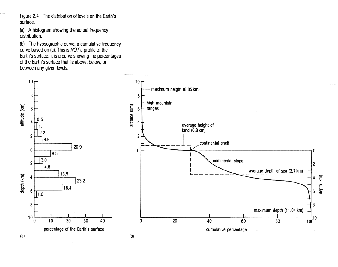
The histogram of elevation shows two peaks, why?
What are the topographic characteristics of divergent, convergent, and transform plate boundaries?
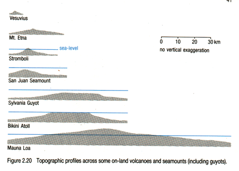
How does an atoll form?
What is a guyot?
The last class we covered the basics of plate tectonic theory. This material is contained in chapter 6 of your book. Today's lecture is on the Ocean Floor and I'll primarily be taking the material from an excellent book The Ocean Basins: Their Structure and Evolution. Chapter 2. Here is a good web page with much of the same material.
The surface of the Earth is mainly covered by oceans 71% oceans and marginal seas, 29% land. The average ocean depth is about 4 km. Based on the greater surface area, one could argue that is more important to study the oceans. This is especially true when it comes to geology because plate tectonic activity is most clearly expressed in the deep oceans. Of course there are other considerations that make the land exploration much more complete: Most of the people live on land and the ocean floor is covered by a thick layer of water that makes it difficult to investigate.
Seawater reflects and absorbs all types of electromagnetic radiation so the various remote sensing methods that have been used to explore the other planets cannot be used in the ocean basins. Because the seafloor is so inaccessible, it would have remained largely uncharted had it not been for some incredibly precise measurements from space. The lecture and Ocean Basins book discuss the structures on the ocean floor and how they are related to plate tectonics. The following two links describe the two methods used today to map the ocean floor: