
 |
DEFINING GEODESY
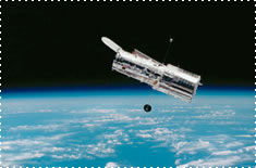 |
| Modern satellites have improved the accuracy of geodetic data over the last three decades |
Etymologically speaking the word geodesy comes from the Greek:
GE: The Earth
DAIEIN: To share
Geodesy is the field of science that is involved in the measurement of the size and shape of the earth as well as its gravity field. Modern geodetic tools such as the global positioning system (GPS), radar altimetry, laser altimetry, synthetic aperture radar, and satellite-to-satellite tracking are accurate enough to monitor time variations in the earth related to plate tectonics, post-glacial, ocean circulation and atmospheric circulation.
Modern geodesy attempts to solve geophysical problems by assimilating observable phenonema (such as variations in the Earth's rotation, gravity, geocenter, and surface deformations) into models. Today, these observations come from a variety of sources including Satellite Laser Ranging (SLR), Very-Long-Baseline Interferometry (VLBI), the Global Positioning System (GPS), and Doppler Orbitography and Radiopositioning Integrated by Satellite (DORIS).
RESEARCH AT IGPP
The Satellite Geodesy research group at the Cecil H. and Ida M. Institute of Geophysics and Planetary Physics, Scripps Institution of Oceanography, University of California San Diego applies laser, microwave, and gravity methods to aid in solving specific geophysical problems, such as modeling the Earth's gravitational field, active tectonics (such as faulting), and terrestrial and oceanic topography.
REFERENCES
François Barlier & Michel Lefebvre. 2001. "A new look at planet Earth: Satellite geodesy and geosciences", The Century of Space Science, 1623-1651. Kluwer Academic Publishers, The Netherlands.
Chao, B. F., 2003. "Geodesy is not just for static measurements any more". EOS, Trans. Amer. Geophys. Union, 84, 145-156.
HOME |
BACKGROUND |
PEOPLE |
GLOBAL TOPOGRAPHY |
RADAR ALTIMETRY |
SYNTHETIC APERTURE RADAR |
LINKS |
CONTACT
Last modified : 07:32:47 PST, 01/05/09