
 |
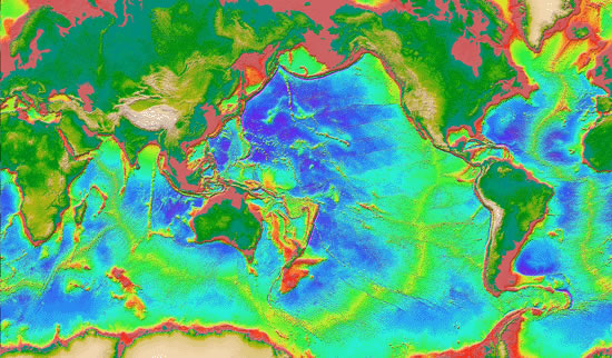
MEASURED AND ESTIMATED SEAFLOOR TOPOGRAPHY
NEW! SRTM30_PLUS V7.0 Coming November 28, 2011
NEW! Global Topography V14.1 June 22, 2011
NEW! Global Topography for Google Earth June 22, 2011
Reference: Smith, W. H. F., and D. T. Sandwell, Global seafloor topography from satellite altimetry and ship depth soundings, Science, v. 277, p. 1957-1962, 26 Sept., 1997.
Quick Contents:
- Seamount Discovery Tool for Google Earth April 27, 2009
- Globe Gallery - December 22, 2005
- Concept for new radar altimeter mission
- Google Explores the 10th Planet: Essay - Febuary 2, 2009
- Science Paper -Global Seafloor Topography from Satellite Altimetry and Ship Depth Soundings
- Review Article -Bathymetric Estimation
- WWW Article -Global Bathymetric Prediction for Ocean Modelling and Marine Geophysics
- Exploring the Earth from Mars: Essay on Confirming Plate Tectonic Theory - June 5, 2001
- Bathymetry from Space: White paper in support of a high-resolution, ocean altimeter mission - April 5, 2001
- Get an ASCII XYZ file
- ftp digital gridded data
- ftp global tiff image
- ftp regional tiff Images
- ftp Plots for 36" HP Plotter
- ftp GMT Scripts to Create Global Tectonic Maps
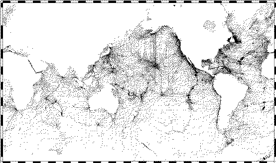
Interactive Maps
The maps below have been sectioned into 16 clickable regions. Clicking on a particular region will open a new window showing the zoomed in region in more detail.
Related Sites
ALL MARINE BATHYMETRY DATA ARE WELCOME!
If you would like to contribute data to the next version of the global topography grid we would be pleased to use it. Any format is welcome, even raw multibeam format. Please send e-mail to dsandwell@ucsd.edu
HOME |
BACKGROUND |
PEOPLE |
GLOBAL TOPOGRAPHY |
RADAR ALTIMETRY |
SYNTHETIC APERTURE RADAR |
LINKS |
CONTACT
Last modified : 15:50:42 PST, 02/25/12